Llwybr Ucheldir Eryri (Snowdonia Highland Trail)
Distance
70 Mi.
(113 KM)Days
2-3
% Unpaved
63%
% Singletrack
15%
% Rideable (time)
80%
Total Ascent
9,887'
(3,014 M)High Point
3,416'
(1,041 M)Difficulty (1-10)
8?
- 9Climbing Scale Very Strenuous141 FT/MI (27 M/KM)
- 8Technical Difficulty Difficult
- 9Physical Demand Very Difficult
- 1Resupply & Logistics Easy
Contributed By

Jacob Martin
Guest Contributor
Jacob Martin is a maker of things from Pembrokeshire, Wales. His goal is to make and do the things that he finds truly interesting in the world. He shares his stories through his blog and newsletter at MidNowhere.co.uk and can regularly be found on instagram @mid_nowhere.
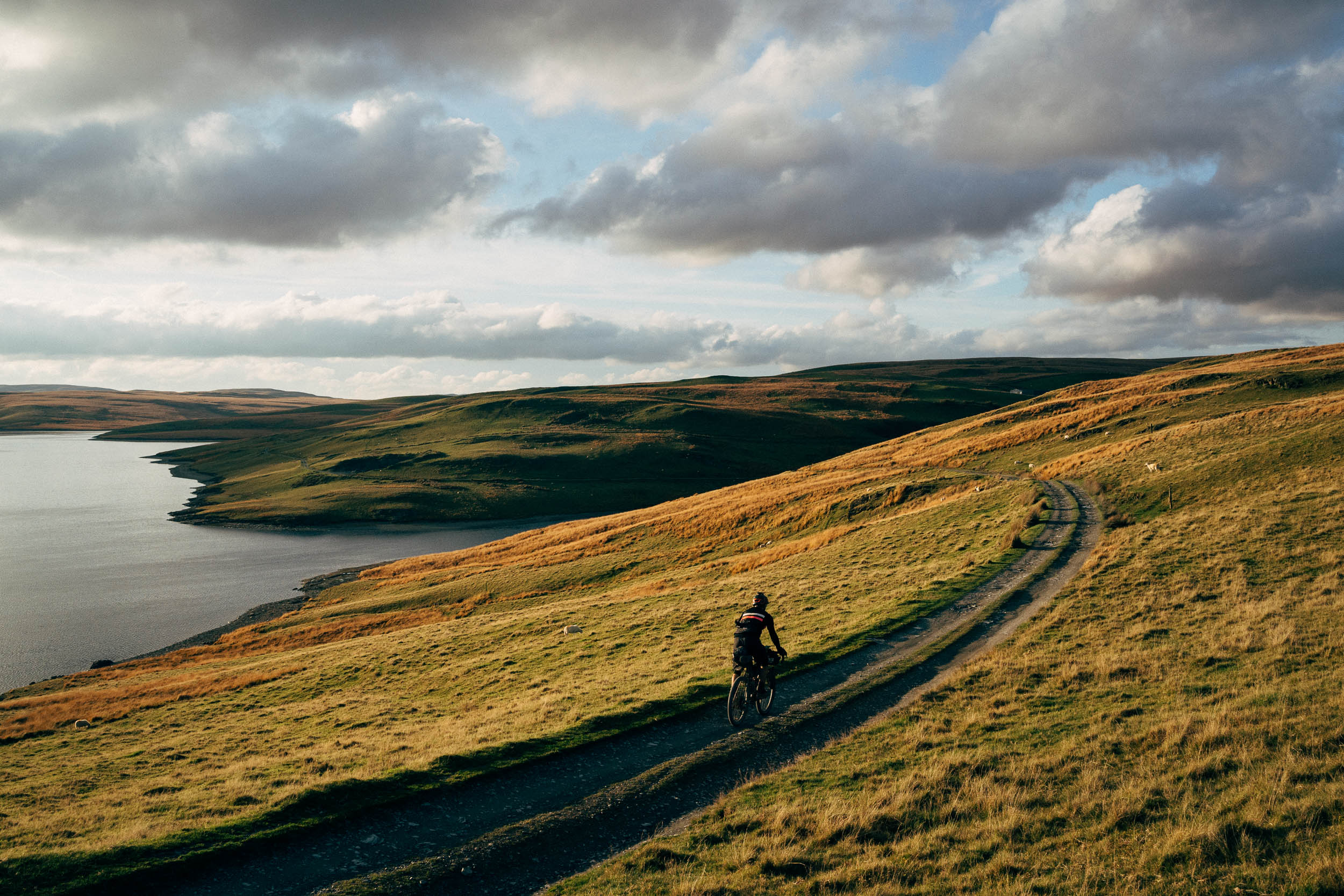
The Llwybr Ucheldir Eryri, Welsh for Snowdonia Highland Trail, takes you on a tour through some of North Snowdonia’s wildest, most beautiful, and interesting landscapes. There are passes, peaks, and plenty of lakes, technical trails, and a trip to the highest point in Wales. Don’t expect this to be a walk in the park. This is quite the ride, quite the journey, and a testing little trip. However, with the hard work comes high reward.
You will wiggle around and at times over Wales’ three largest mountain groups, the Snowdon Massif, Y Carneddau, and Y Glyderau. You will tour a UNESCO world heritage site, a national park, and explore some of Wales’ best off-road biking.
The route takes you on a 73-mile (118-kilometre) loop around the highlands of Eryri. You could start and finish anywhere you like, but it has been designed to start in Rhyd Ddu on the west of Snowdon with a mellow start through Beddgelert and along Gwynant before a couple of open mountain passes and rocky descents bring you to the Gwydyr forest. The trail travels around the forest via Betws Y Coed and the singletrack of the Gwydyr Mawr trail before dropping into Dyffryn Crafnant and a little push up and over the Crimpiau pass to Capel Curig and Dyffryn Ogwen via one glorious flowing trail.
After this, the route guides riders along what I would say is Wales’ most spectacular valley, squeezed in between the Glyderau mountains on your left and the Carneddau on your right. As you creep in further and further, the mountains roll in closer and reveal themselves more. The rocky ridge of Tryfan on your left is the most spectacular and my favourite of them all.
The ride continues onwards through some of the Slate Landscape of Northwest Wales UNESCO world heritage site at Penrhyn and Dinorwig before passing through Llanberis for an epic crescendo on Yr Wyddfa (Snowdon). This is an absolute classic and must-do Welsh mountain bike adventure with a tough ride and hike up followed by about six kilometres of descent down the Ranger path back to where you started.
With this route, I wanted something that didn’t just give you a flavour of the area but threw you in the deep end. I hope you enjoy it.
Route Development
I set out to develop a route that gives a grand tour of the best riding in this part of the Snowdonia mountains. I travelled up from Pembrokeshire for years to explore this area and plotted out a draft route—one that a group of friends and I tested last year. We had a great time, but there were a few imperfections that made it not quite right. This past summer, I decided to jump right in, move up to the mountains, and get to know them that little bit better. With that, I explored, linked up trails, and tested to finally get this route finished.
Route Difficulty
The route climbs and descends quite significantly, including a full ascent to the highest point in Wales at the top of Yr Wyddfa/Snowdon. The climbs can be tough—and at times the descents even tougher—but they are certainly worth the effort when you see the views and ride some of the best trails in the country. Expect a few sections of hike-a-bike and some technical, rough descending, but also expect some less challenging breaks in between on a whole variety of trails and landscapes. It is certainly a mountain bike route, and a gravel bike would not be enough for many sections of the ride. Some extra spare tubes and a well-stocked repair kit wouldn’t go amiss. Technical and physical difficulty is an 8-9, logistics and resupply a 1, there are plenty of places to buy food, fill water, and rest your head at night.
 This route is part of the Local Overnighter Project, which was created to expand our growing list of worldwide bikepacking routes—the first and largest of its kind—and create an independent map and catalog of great bikepacking overnighters, curated by you, from your own backyard. Our goal is to have accessible routes from every town and city in the world. Learn More
Submit Route Alert
As the leading creator and publisher of bikepacking routes, BIKEPACKING.com endeavors to maintain, improve, and advocate for our growing network of bikepacking routes all over the world. As such, our editorial team, route creators, and Route Stewards serve as mediators for route improvements and opportunities for connectivity, conservation, and community growth around these routes. To facilitate these efforts, we rely on our Bikepacking Collective and the greater bikepacking community to call attention to critical issues and opportunities that are discovered while riding these routes. If you have a vital issue or opportunity regarding this route that pertains to one of the subjects below, please let us know:
Highlights
Must Know
Camping
Food/H2O
Trail Notes
- The Gwydyr Forest, where you will ride forest roads, past lakes, and on some rough and technical singletrack. The route follows some of the Gwydyr Mawr trail here. However, if you’d like to extend the route, you could follow the full trail through the forest. Look out for the red arrows after you pass through Betws Y Coed.
- Crafnant is a beautiful lake and valley you pass through right after leaving the Gwydyr Forest. You leave the valley with a short hike-a-bike over the pass before a flowing descent down into Capel Curig.
- Wales’ most spectacular valley. The route travels the full length of Dyffryn Ogwen from Capel Curig to Bethesda. This valley is, in my opinion, the most spectacular in Wales. As you travel further into the valley, the striking rocky ridgeline of Tryfan reveals itself from behind the mountains to your left.
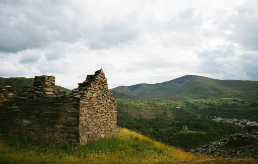
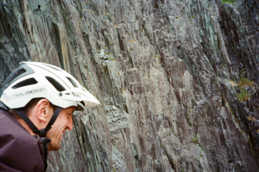
- The Slate Landscape of Northwest Wales is a UNESCO world heritage site. The route takes you in and around a number of old and still current slate workings spread through the mountains. I find the huge old workings and abandoned infrastructure fascinating and their appearance both beautiful and an ugly scar at the same time. Whichever way I look at it, however, the scale of the operation where whole sections of mountain have been dug away is extraordinary. The quarries in Penrhyn and Dinorwig were once the two largest slate workings in the world. You’ll see and feel their scale as you pass by.
- Reaching the highest point in Wales. Yr Wyddfa/Snowdon is a classic Welsh mountain bike adventure. This route takes you up the Llanberis Path and then down the steep and technical Ranger Path for over six kilometres of descent where you drop over 900 metres! The climb is about 50/50 riding and hiking by distance, so chill and enjoy the walk. You’ll pass many tourists on this path. From the times I have made the ascent, there is a great laugh to be had with those hiking and how shocked they are that you’re taking your bike with you. The encouragement they give you will help push you to the top. The descent is quite the wild ride. It’s mostly ridable with a couple of short sections where all but the very very best will have to dismount (rumour has it that Dan Atherton did this from top to bottom in seven minutes!).
- Yr Wyddfa/Snowdon: There is a voluntary restriction on mountain biking on the mountain from the 1st of May to the 30th of September between 10 a.m. and 5 p.m. This is due to the popularity of the mountain with walkers and to avoid accidents between bikers and hikers. This isn’t the law or enforced in any way but is best for everyone and the longevity of biking on the mountain if stuck to, so start early or finish late when you are going up here. There is plenty of daylight during that period of the year, so you should have plenty of time.
- Best bike: There is some proper mountain biking in here, the main part being up and down Yr Wyddfa/Snowdon. You’ll want a hardtail here or at the very least some chunky tyres and the option to get your saddle down.
- Time of year: I’d aim for somewhere between late May and September. It can be nice or horrific the weather here just about any day of the year. You’re heading into the mountains, so it goes without saying you’ll need plenty of warm layers and full waterproofs just in case. Think about what you might need to if someone gets hurt or you get a mechanical.
- The Framed Bicycle Co. in Llanberis is a friendly shop for repairs or supplies. For general camping and outdoor gear, there are great shops in Llanberis, Beddgelert, Capel Curig, and Betws Y Coed.
- Where to start? You could start the loop at just about any point. We planned to start in Llanberis to tackle Snowdon first, but with bad weather coming in that morning, we decided to start in Rhyd Ddu instead and finish with Snowdon. This worried us at first, tackling the hardest part right at the end. However, in the end, I think this was the best thing and felt like an amazing way to finish the weekend with one of the best descents in the country. It is designed to be ridden in an anti-clockwise direction; riding in the other direction would not be advised.
- Public transport: The route can be accessed by train at Betws Y Coed or alternatively Bangor, which has a much greater timetable of services, just a short pedal from Bethesda.
- Alternative route: If you would like to avoid the most serious off-road riding or the weather is particularly bad, there is an alternative well-surfaced bridleway between Llanberis and Rhyd Ddu through Bwlch Maesgwm. Find it by following the small road that goes past the Youth Hostel SW out of Llanberis.
- Practise your Welsh. Welsh is the first language around the mountains here, and the locals really appreciate any effort put in to speak the language. Start with “Bore da” for good morning and “Diolch” for thank you. Have a look online for pronunciation; it can be tricky for those new to the language.
- There are plenty of campsites, hostels, and other accommodation options along the route.
- I would recommend the basic Gwern Gof Uchaf campsite in the Ogwen. This sits right below my favourite mountain, Tryfan. There aren’t many campsites with such spectacular views.
- Wild camping is technically not legal in Wales. I would refrain from doing it on or near Yr Wyddfa.
- There are a number of shops, pubs, cafes, and good pizza stops along the route. Water is also fairly easy to come by, but carry at least a couple of bottles each.
- There are small grocery stores in Beddgelert, Dolwyddelan, Betws Y Coed, Bethesda, and Llanberis.
- Caffi Siabod in Capel Curig is a classic stop on any adventure around these mountains.
- Pizza at Hangin’ Pizzeria in Betws is well worth the stop! However, everyone else knows how good it is too, so be prepared for a little wait.
- Llanberis has a whole host of cafes, pubs, and restaurants to get you ready for the ride up Yr Wyddfa. If you have some extra time here or need some food before you head home, Y Fricsan (a 10-minute cycle off route) in Cwm Y Glo is absolutely the best spot around.
The route is a loop, so you can start and finish wherever you like. However, I’ve designed it to begin from near the village of Rhyd Ddu on the West side of Yr Wyddfa (Snowdon). This gives you quite the mellow start, pottering along through Beddgelert forest and weaving around the old steam railway, before coming into the village of Beddgelert itself then climbing gently out along Nant Gwynant.
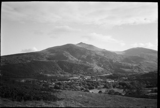
Once you pass Llyn Gwynant the route turns right and hikes up and over a small pass into the next valley. Here, you will have a spectacular view of the Snowdon Massif and the top of Yr Wyddfa that you will come to at the end of the trip. The trail from here drops down into Dolwyddelan, passing the Castle of the same name that was built in the 13th century by Llywelyn ab Iorwerth, the ruler of the Kingdom of Gwynedd.
Once through the village, the trail climbs gently across the side of Moel Siabod before dropping sharply down a rocky track to Afon Llugwy. This is the start of a long section through the Gwydyr Forest. There are forest roads, lakes, and a whole load of singletrack from the Gwydyr Mawr trail mixed in. The section is broken in half by the village of Betws Y Coed, a good place to stock up on snacks, replace gear, or fill up on pizza before continuing through the forest.
You leave the Gwydyr Forest when you reach Llyn Crafnant. This is a lake in a secluded little valley that only has one way in and out by road. However, you can leave over the pass with a little hike-a-bike that treats you to a lovely flowing two kilometres or so of descent down into Capel Curig. Capel Curig sits at one end of Dyffryn Ogwen, which is, for me, the most spectacular valley in Wales. The trail and valley are squeezed in between the Glyderau mountains on your left and the Carneddau on your right. As you creep in further and further, the mountains roll in closer and reveal themselves more. The rocky ridge of Tryfan on your left is the most spectacular and my favourite of them all. The route through the valley follows the old road from the 1700s that came before Thomas Telford’s relatively modern A5 that sits on the opposite side of the river.
As you get to Bethesda and the end of Dyffryn Ogwen, the signs of past and present slate mining will become more and more present, continuing from here over through Dinorwig and onto Llanberis. This whole area is part of the UNESCO World Heritage Site for the Slate Landscape of Northwest Wales. I find the huge old workings and abandoned infrastructure fascinating and their appearance both beautiful and an ugly scar at the same time, whichever way I look at it. However, the scale of the operation where whole sections of mountain have been dug away is extraordinary, with the quarries in Penrhyn and Dinorwig at one point being the two largest in the world. You’ll see and feel their scale as you pass by.
From Llanberis, the trail follows the Llanberis Path to the summit of Yr Wyddfa. The ascent is about 50/50 riding and hiking by distance, so chill and enjoy the hike. From the summit, the trail goes back on itself a few hundred metres before crossing the railway and making the six-kilometre descent down the Ranger path. It is quite the ride, and you’ll understand why you pushed your bike so far up here.
Terms of Use: As with each bikepacking route guide published on BIKEPACKING.com, should you choose to cycle this route, do so at your own risk. Prior to setting out check current local weather, conditions, and land/road closures. While riding, obey all public and private land use restrictions and rules, carry proper safety and navigational equipment, and of course, follow the #leavenotrace guidelines. The information found herein is simply a planning resource to be used as a point of inspiration in conjunction with your own due-diligence. In spite of the fact that this route, associated GPS track (GPX and maps), and all route guidelines were prepared under diligent research by the specified contributor and/or contributors, the accuracy of such and judgement of the author is not guaranteed. BIKEPACKING.com LLC, its partners, associates, and contributors are in no way liable for personal injury, damage to personal property, or any other such situation that might happen to individual riders cycling or following this route.
Further Riding and Reading
Here are some connected/nearby routes and related reports...
Please keep the conversation civil, constructive, and inclusive, or your comment will be removed.


