San Jose del Pacifico Grand Dirt Tour, Oaxaca
Distance
244 Mi.
(393 KM)Days
6-7
% Unpaved
80%
% Singletrack
0%
% Rideable (time)
99%
Total Ascent
24,500'
(7,468 M)High Point
9,612'
(2,930 M)Difficulty (1-10)
7?
- 7Climbing Scale Strenuous100 FT/MI (19 M/KM)
- 5Technical Difficulty Moderate
- 7.5Physical Demand Difficult
- 5Resupply & Logistics Moderate
Contributed By

Cass Gilbert
Contributing Editor
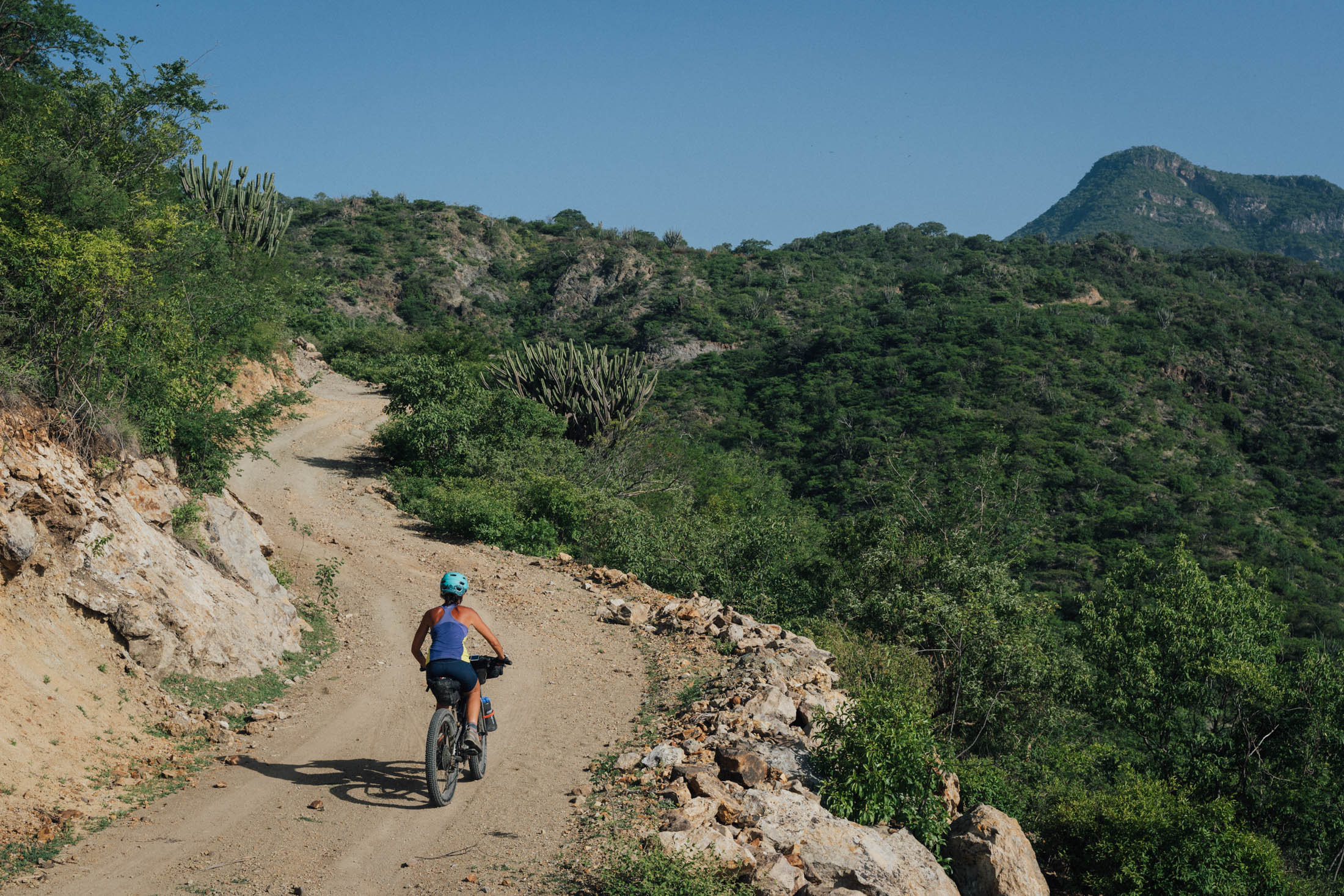
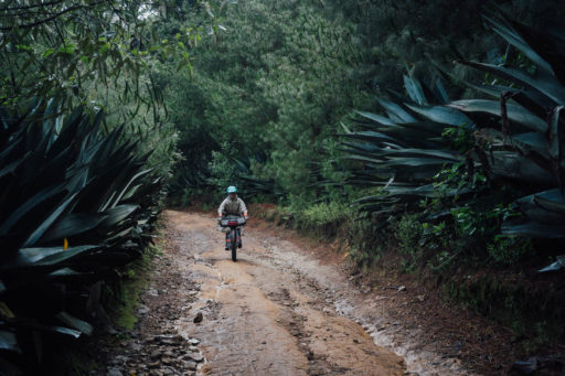
The San José del Pacífico Grand Dirt Tour is a week-long loop that showcases Oaxaca and its geographical, botanical, and cultural diversity. Setting off from Templo de Santa Domingo de Guzmán, it exits the state’s capital city and its cultural and artistic hub in a somewhat unorthodox way, setting the tone for this distinctly backcountry route.
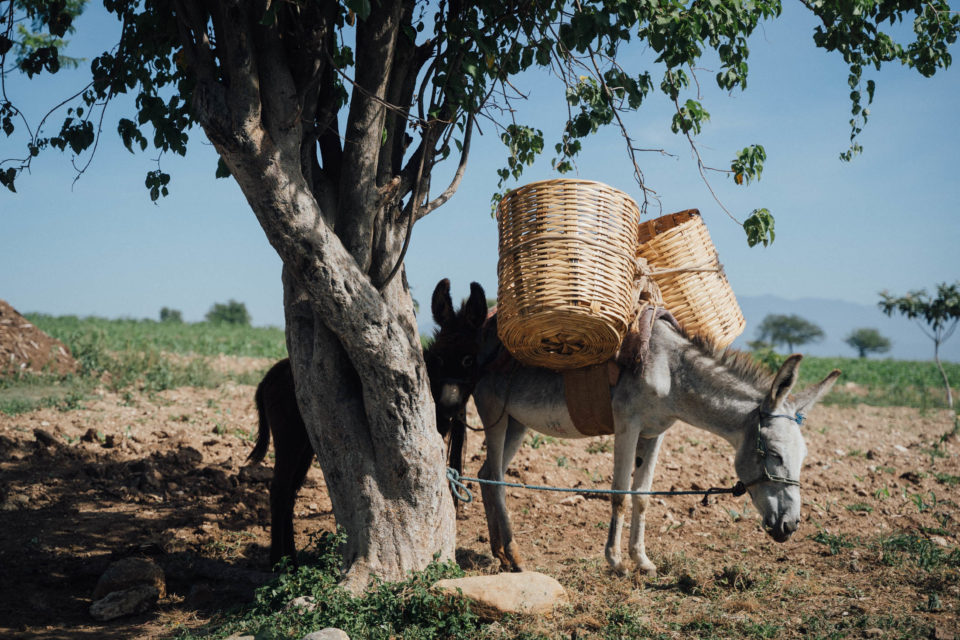
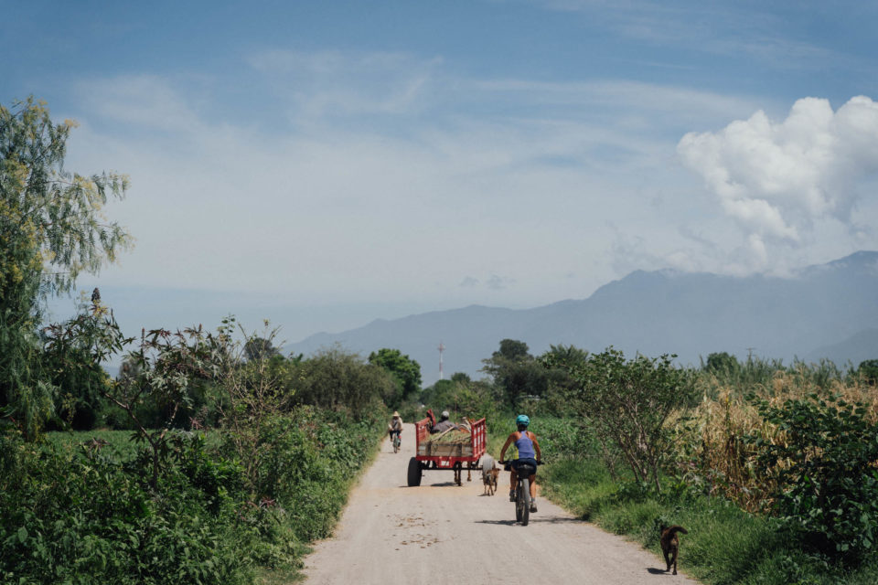
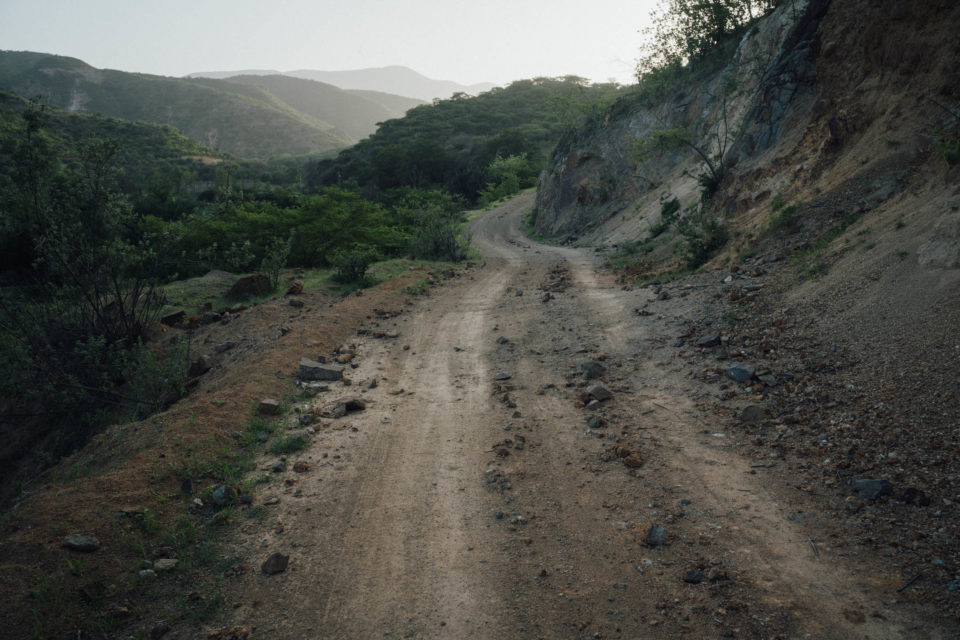
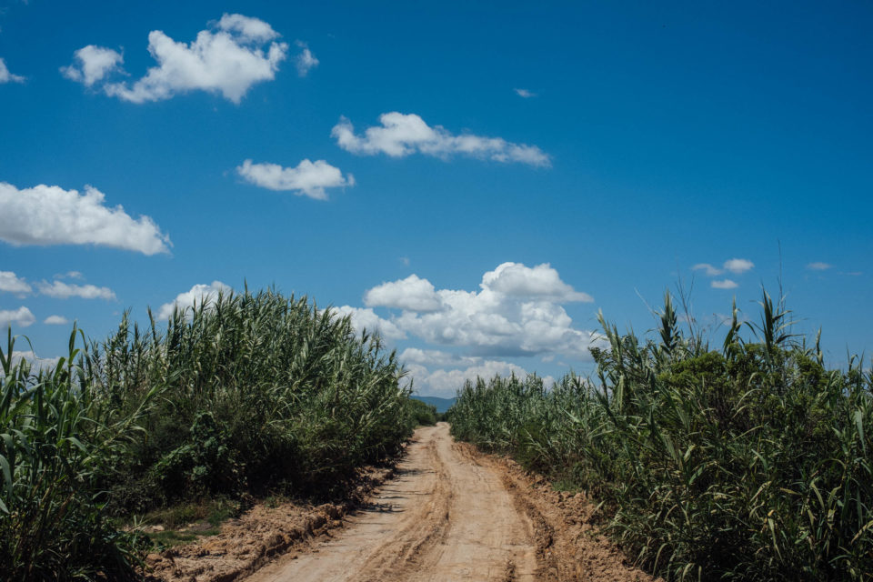
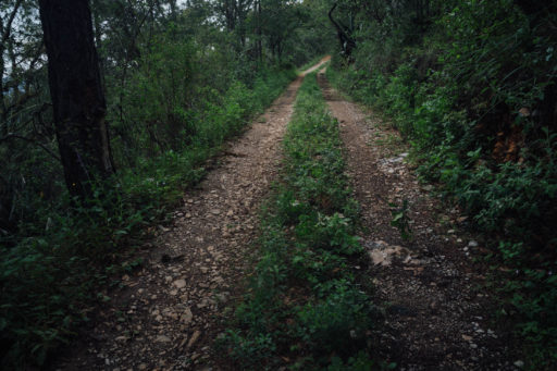
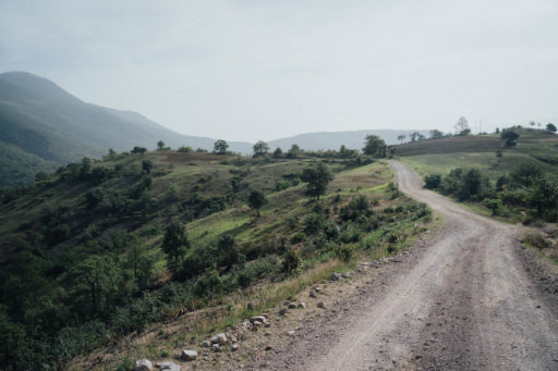
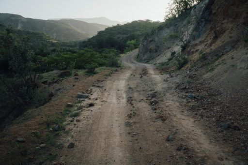
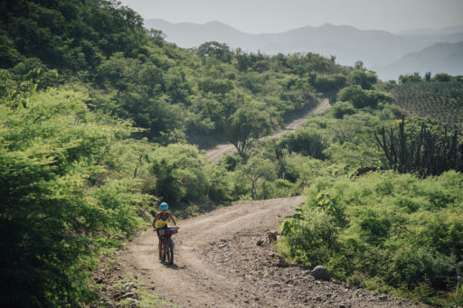
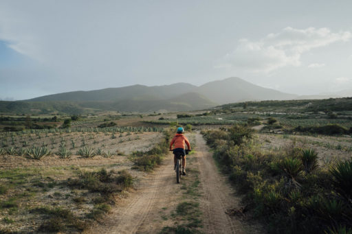
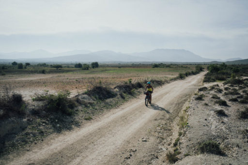
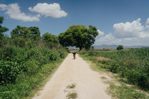
Heading south, the outward leg consists primarily of rural terracerías – dirt roads – that connect small communities as they wend their way from one milpa – field – to the next. It eases bikepackers into dirt road touring, Mexico-style, and in all likelihood, you’ll be sharing bumpy thoroughfares with dilapidated pickup trucks, parked donkeys, fellow cyclists, many of whom are on singlespeeds, as well as horse and carts. Paralleling it and only crossing it on occasion, it almost completely avoids the paved highway to the coast, providing instead a more gentle insight into traditional Oaxacan farming life.
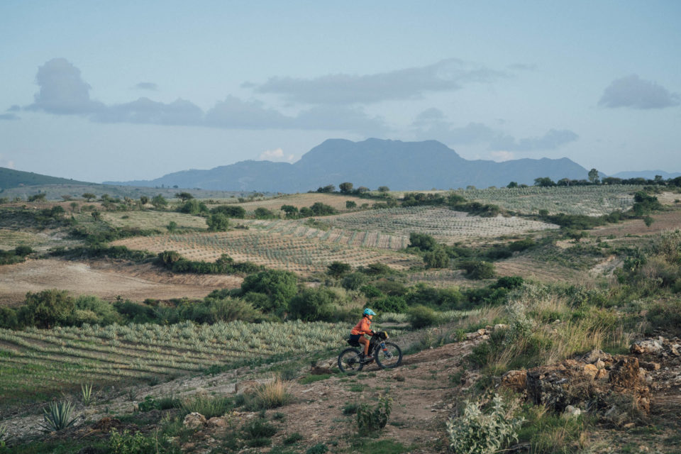
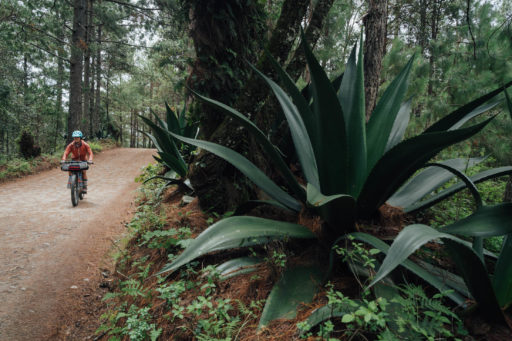
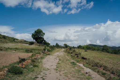
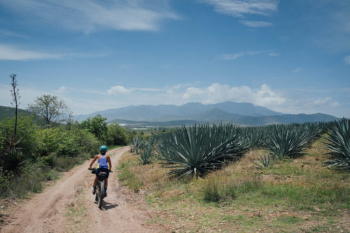
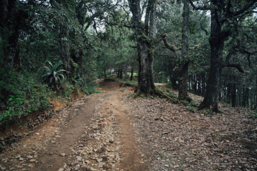
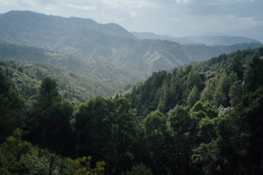
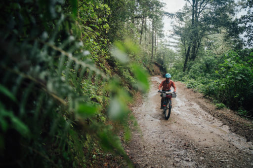
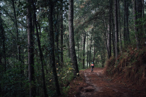
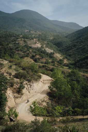
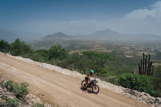
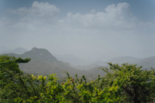
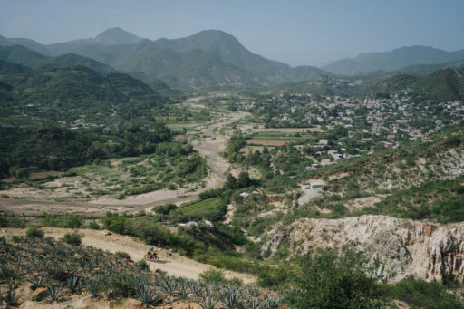
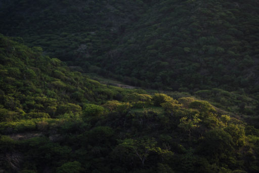
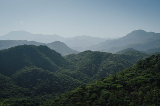
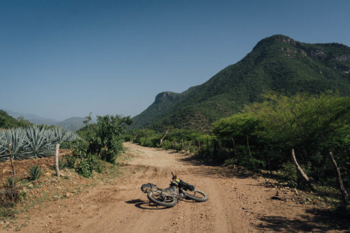
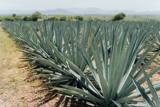
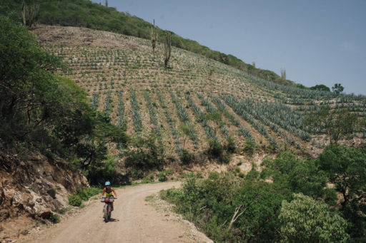
Leaving the Valles Centrales, the route strikes south-east into the cloud forest towards the popular, highway-side settlement of San José del Pacífico – a great spot to take an additional day’s rest, especially if your legs are still easing into mountain riding. After coursing up and down through the lush, often misty forests typical to this area, the return loop is a wilder and less travelled affair. First it hurdles a remote mountain high pass that’s close to 2,900 metres in elevation, tracing an old mtb race, the Reto Totohua, that was last held in 2013. The descent down the other side is a long and thrilling one, eventually breaking out across a hot, dusty plain that’s home to vast patches of agave plantations. Those who enjoy an evening tipple will be pleased to know that Oaxaca is famed for its mezcal, best served from a small, travel-friendly (and reassuringly lightweight) jícara, a cup fashioned from the gourd of the calabash tree.
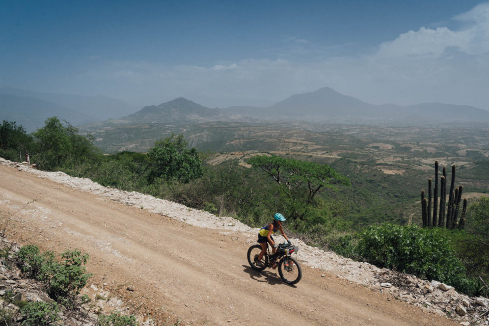
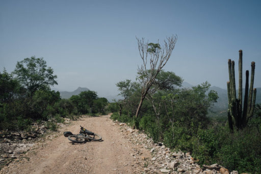
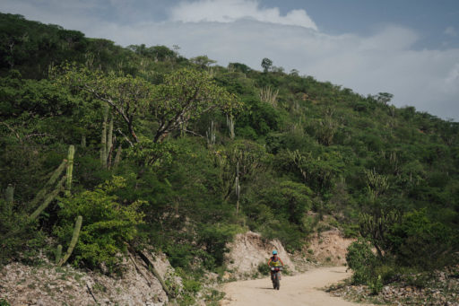
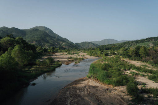
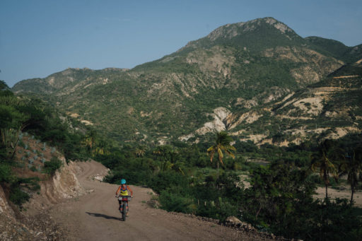
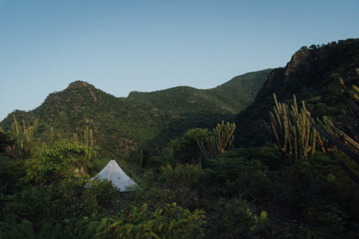
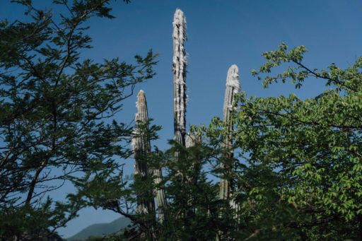
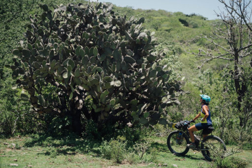
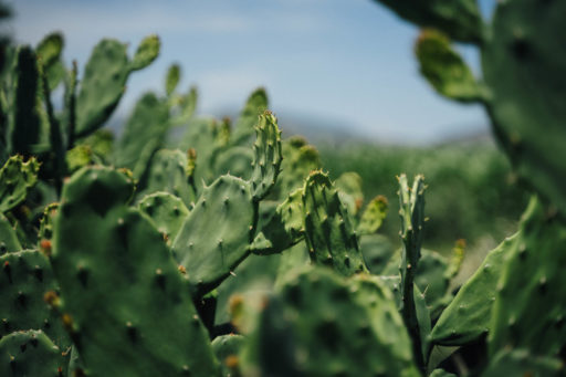
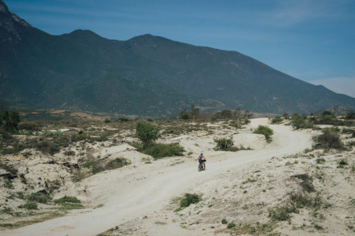
Dropping down to a balmy 900 metres in altitude, sweaty brows are to be expected, as is the sight of banana and papaya trees, which grow in abundance at this elevation. Tracing the shores of the languid Río Quiechapa, the route then climbs back into the cooler climbs of the mountains once more, striking deep into a rugged land of giant groves of prickly pear and bearded columni cacti. Continuing its northwards roll, the route eventually connects with the Mitla Valley for the final, relatively flat stint home to Oaxaca, with its promise variety of enticingly edible rewards.
Don’t be too much of a rush, though. This last stretch is an especially appealing one, because it connects a number of small villages that are each known for a particular craft – including basket making and barro rojo pottery – before passing the low key, Zapotec archeological site of Dainzú, which date back some two millennia. Continuing its cultural tour, it includes a detour up to Teotitlan del Valle, famed throughout Mexico for its textiles, many of which use plant and insect pigments as natural dyes – keep a spare Voilé strap handy in case you want to invest in a beautiful rug!
Onwards, it’s just a short ride to Santa María del Tule and its refreshing nieves, from where a convenient bike path beelines straight into the city. Take the time to pause to inspect a particularly impressive Montezuma Cypress specimen that has resided there for over two thousand years, and note that you’ll be in good company too, as the revered Prussian botanist and explorer Alexander von Humboldt did exactly the same in 1802. At 14 metres wide and 42 metres in circumference, it’s claimed the tree is the stoutest tree in the world.
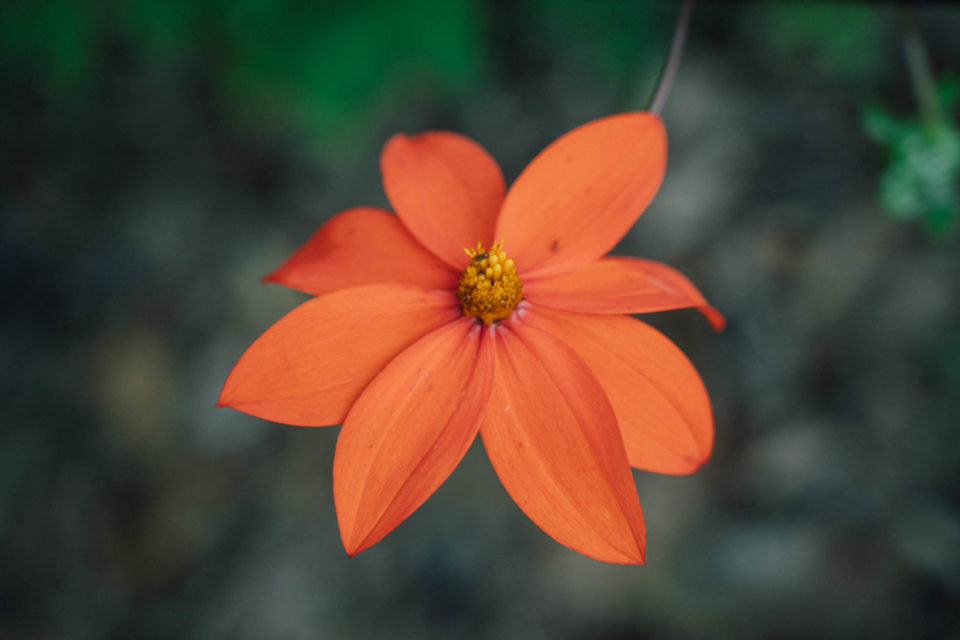
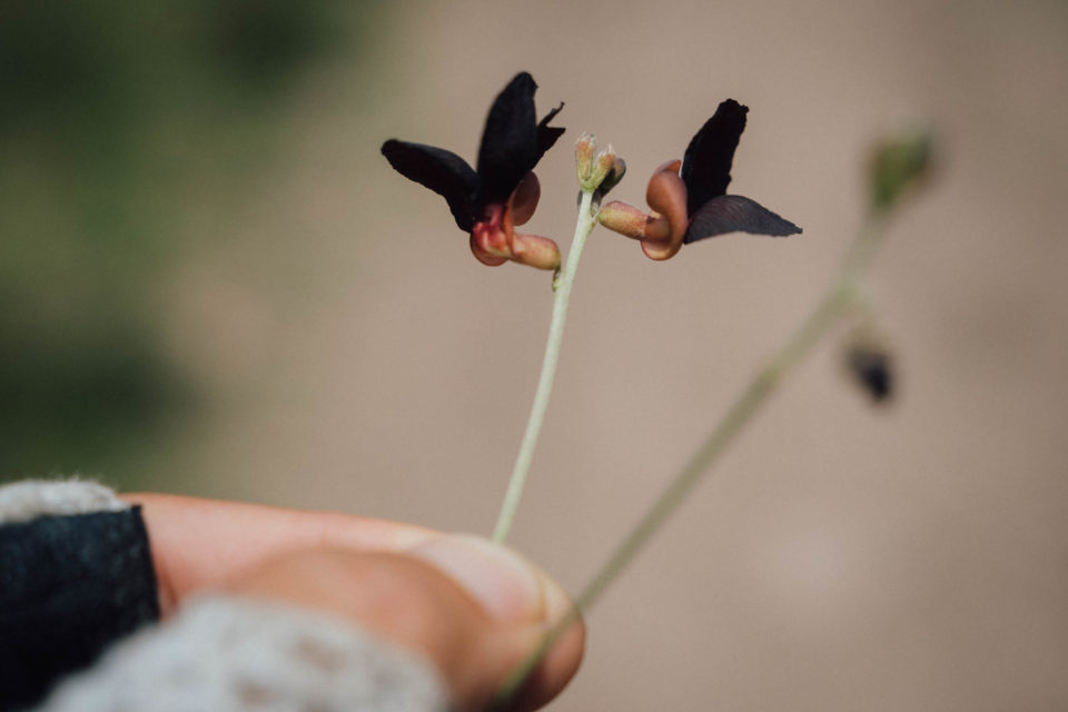
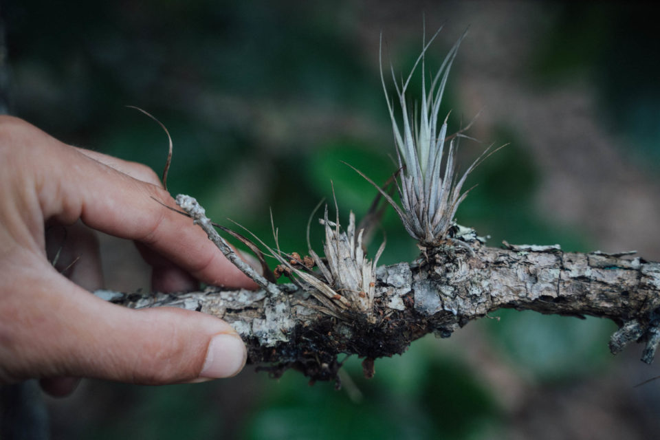
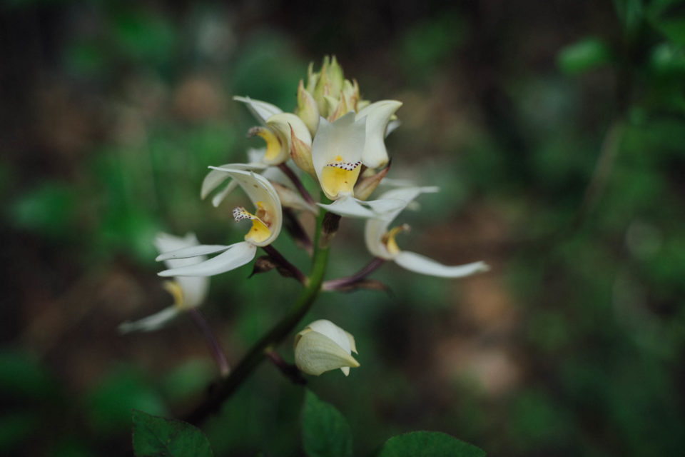
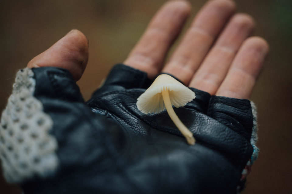
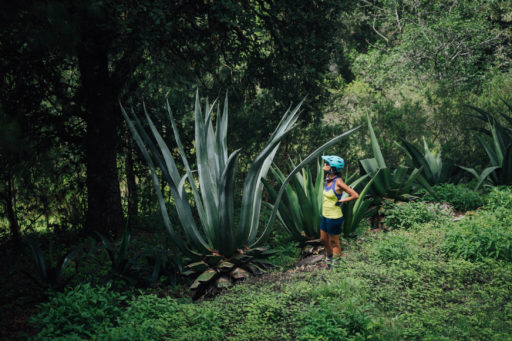
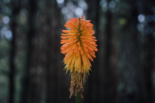
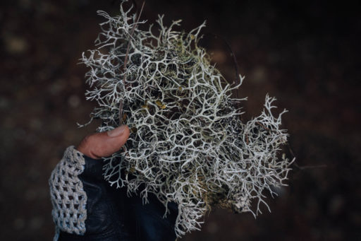
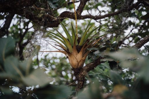
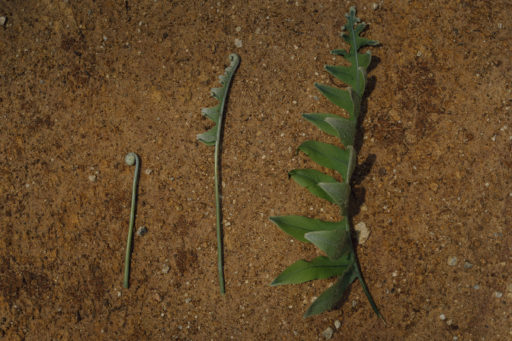
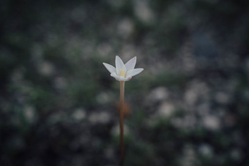
Tule aside, we’ve barely even touched on the state’s remarkable biodiversity, which draws biologists from the world over. There’s no better way to prime yourself for a visit than by reading the entertaining Oaxaca Journal by Dr Oliver Sacks – the acclaimed neurologist, writer, and fern enthusiast – in fact a local fern is named after him. Keen-eyed bikepackers may well spot a wide variety of plants throughout the route, many of which are endemic to this area, can are especially noticeable on the shoulder of the rainy and dry seasons. We’ve included a few examples below and captioned names within the photoset should you wish to partake in this Oaxacan botanical treasure hunt.
In order of presentation: Red Dahlia, Purple Bush-Bean, Bromeliad (Tillandsia Oaxacana), Orchid (Govenia utriculata), Bonnet (Mycena).
The southern Pacific states of Oaxaca and Chiapas are also known for their mushrooms, which can be appreciated in a number of ways. If you’ve come across the name María Sabina, you’ll likely know about Oaxaca’s popularity amongst overseas travellers, drawing famous creatives from around the world. Sabina’s sacred healing ceremonies were based around the use of psilocybin mushrooms, and somewhat controversially, were brought to fame in a Life article in the late ’50s.
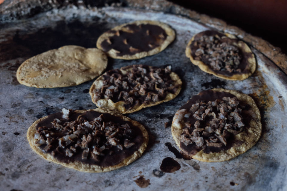
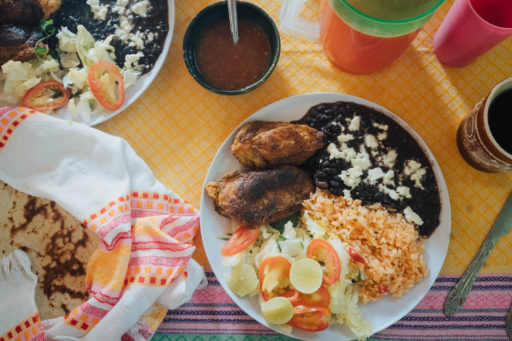
Come rainy season, foragers will love this area too, because the fungi that grow all around 2440m San José del Pacífico also taste delicious within the fold of a tlayuda. These handmade dishes, typical to Oaxaca, are a foodie bikepacker’s dream. Cooked on a comal, they consist of a large, crunchy, partially toasted, homemade tortilla covered with a spread of refried beans, cabbage, avocado, meat, Oaxacan cheese, and fresh salsa. Quite delicious!
Alternates and extensions
For those coming from afar, Oaxaca deserves as much time as you can make for it and if you live in Mexico, it’s a destination worth getting to know over a series of visits. For this reason, we’ve included a number of alternatives to riding in and out of the city, as well as a short ride to San Mateo Rio Hondo to extend your trip at its midpoint and spend more time in the high country.
The full loop includes a fun and unorthodox route out of Oaxaca. But if you need to save time, there’s a way to exit the city that is considerably more direct and will save you half a day, even if it means riding the highway for a stint – see the RWGPS gpx here. It passes by San Bartolo Coyotepec, known for its barro negro pottery.
If you’re running late at the end of your trip, it’s easy enough to edit out the detour to Teotitlán del Valle (as worthwhile as it is). Conversely, should you want to eek out the ride, consider visiting the Mitla archaeological site and the sprawling Tlacolula market, the latter of which is especially hectic on Sunday. The Camping and Lodging tab includes a great place to stay in Mitla. Use the Mitla Connector gpx as a backcountry, low traffic way of riding there, keeping you completely off the highway. To really pack it in, you could climb up to Hierva El Agua too, and the spend the night up there to enjoy it to yourself in the morning. See the Meandros en Mitla route for ideas.
Keen to see the Pacific? If you want to peel off to Mazunte and Zipolite, on the coast, this connector will get you there from San José del Pacífico. You could then hop on a minibus back and continue along the route.
Additionally, we’ve included day rides into nearby valleys to bookend your trip (see the Dirt Road Day Rides box out below), and if that’s not enough, I’d recommend a foray into the Sierra Juárez too, the range that overlooks the city to the north. With the right steed – think capable mountain bike – the San Jose del Pacifico Grand Dirt Tour pairs well with the Hebras de Ixtepeji forest road and singletrack ride, which is a 2 to 3 day exploration of the Sierra Norte.
Check out the Trail Notes tab below for more details – and investigate the various points on the RWGPS map for places to mix and match the route – so you can tailor your Oaxaca visit to suit different timelines, riding preferences, and bike setups.
Lastly, for anyone with a longer itinerary still, consider heading over to the nearby Tehuacán-Cuicatlán Biosphere Reserve (a 1.5-hour bus ride away or reachable on this connector), or embarking on a mountain crossing to Puerto Escondido on the Pacific coast – via the Oaxaca Escondidada route. You could even use the San Jose del Pacífico Grand Dirt Tour as a warm up/shakedown ride to a bigger journey south, following the Trans Mexico (Sur).
Dirt Road Day Rides
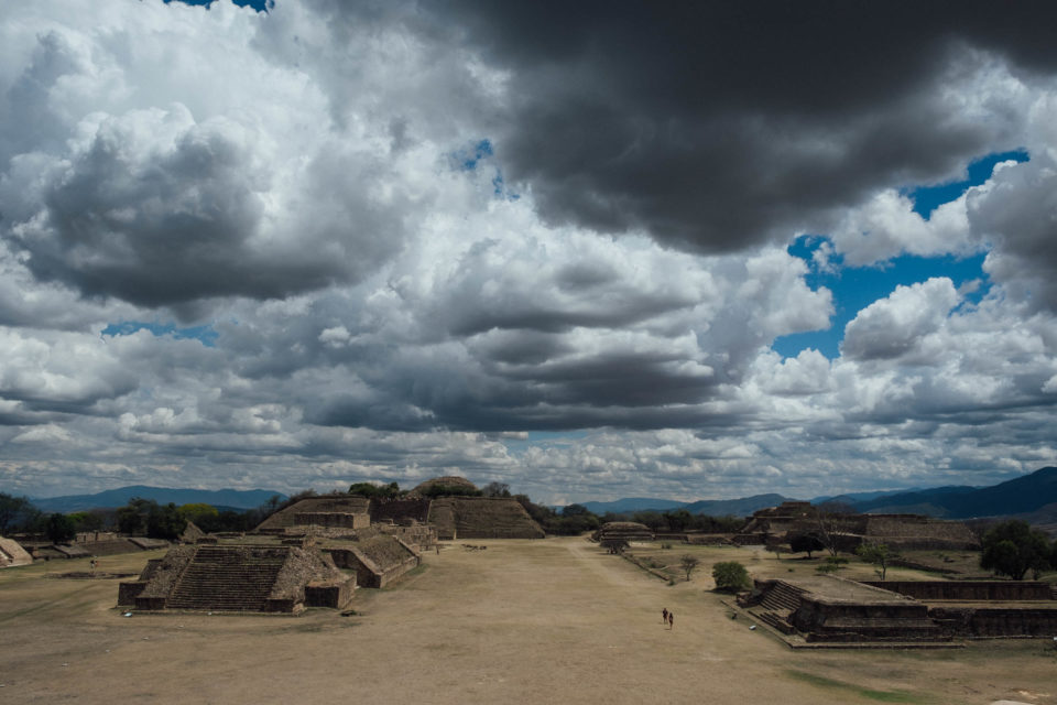
The Grand Dirt Tour aims to showcase the many facets of this beautiful and culturally diverse state, and for those coming from afar, the city of Oaxaca de Juaréz makes a great base to learn about Zapotec culture and traditions. As such, it’s well worth allotting yourself at least a few days to enjoy the fantastic regional fare, visit the Jardín Etnobotánico de Oaxaca, pop into the Museo Textil, and ride out various nearby archaeological sites – like nearby Monte Albán and Atzompa. Find several dirt road day rides linked under the Trail Notes tab and more here.
Factor in delicious local coffee and fare that’s considered amongst the finest in the country, and you’ll begin to see why this Mexican state is such a bikepacker’s delight!
With thanks to outdoor educator and artist Emma Bucke for sharing her beautiful botanical illustration, as used in the San José del Pacífico Grand Dirt Tour route badge. And for her knowledge of (and enthusiasm for) the natural world, which helped greatly to shape this trip.
 We’re thrilled to announce our comprehensive Bikepacking Routes Network guide for Oaxaca, Mexico. Find an extensive routes map, detailed information about the arts, crafts, food, and daily life in this enchanting state, plus everything you need to know about experiencing an extensive network of dirt roads and trails by bike, linking mountain ranges, pueblos, and rolling landscapes from the old capital…
Submit Route Alert
As the leading creator and publisher of bikepacking routes, BIKEPACKING.com endeavors to maintain, improve, and advocate for our growing network of bikepacking routes all over the world. As such, our editorial team, route creators, and Route Stewards serve as mediators for route improvements and opportunities for connectivity, conservation, and community growth around these routes. To facilitate these efforts, we rely on our Bikepacking Collective and the greater bikepacking community to call attention to critical issues and opportunities that are discovered while riding these routes. If you have a vital issue or opportunity regarding this route that pertains to one of the subjects below, please let us know:
Highlights
Must Know
Camping
Food/H2O
Trail Notes
Resources
- Roller coaster climbs and monster descents through the crumpled folds of the Oaxaca’s Sierra Norte and Sierra Sur.
- Experiencing Oaxaca’s remarkable biodiversity; rub shoulders with bromeliads, orchids, ferns, and agaves (ouch!)
- Quiet, traffic-free, backcountry riding for almost the entire route.
- A visit to San José del Pacifico and San Mateo Rio Hondo and its intriguing mushroom culture.
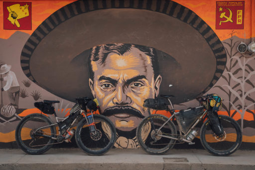
- A chance to spend time in Oaxaca de Juaréz itself, an enclave of creativity, fine food, and Zapotec culture.
- The option to work in a number of complimentary day rides, or weekend bikepacking loops, to make the most of your time in the region.
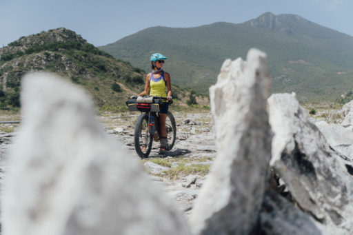
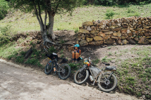
- Best bike: A rigid mountain bike or hardtail with a 2.3″ to 2.6″ tyre is the best steed for this route, due to the mixed terrain, the extended climbs, and the often steep grades. Still, because there’s nothing ‘technical’ along the way in terms of terrain, a traditional tourer works well too. If you’re aboard a gravel or drop handlebar bike, gearing similar to that of a mountain bike is most appropriate. Fit the widest tyres that you can and expect to be jostled around at times. Whatever bike you choose, pack light, as there’s a lot of climbing to contend with. Find more in the Bikes, Rides, and Gear section of our extensive Oaxaca Bikepacking Routes Network Guide.
- Direction: We’ve routed the loop in an anti-clockwise direction, as it offers a more mellow introduction to dirt road riding in Mexico, finishing up with an easy-going cruise through the culture-rich Mitla Valley, with a detour to Teotitlan del Valle for a chance to purchase one of its naturally dyed, handmade rugs. However, the route also works really well in reverse. Ridden clockwise, it throws riders straight into the more adventurous half of the route, with a more gentle exit through rural countryside to round it off. Riding it clockwise also avoids the knee-popping climb into San Jose del Pacífico. There are a few minor alternates marked on the map for those riding in a clockwise direction and note the possibility of one-way roads in towns when following the gpx file.
- Please see the notes at the top of this page for details on a reroute between Cieneguilla and San Agustín Mixtepec.
- Many of these dirt roads see little travel. A wave, a friendly greeting, and even some conversation go a long way within the small Zapotec communities, especially when crossing their land.
- For this reason, some Spanish language skills are highly recommended, as much of this route sees few foreign visitors.
- Best time of year: Oaxaca is a popular destination throughout the year, with November to February being the high season. Bear in mind that during the dry season (November to April/May), dirt roads become increasingly dusty, streams can run dry, and temperatures soar as the months go by – especially as you descend in elevation. By April, it’s sizzling hot and the landscape also becomes increasingly dull and brown. In contrast, the rainy season (mid-May to October) brings lush countryside and more bearable midday riding temperatures, but expect heavy later afternoon or nightly downpours. Thankfully, rain in the mountains of Oaxaca is rarely an all-day affair, unless there’s a storm system lingering on the Pacific coast or the Gulf of Mexico, in which case it can be rainy and overcast for a few days. Mid October through January are probably the best times to ride here, as the landscape is still green, the heaviest rains have passed, and the temperatures aren’t yet oppressive – within these months, November is perhaps the best. You could even tie in a trip with Día de Muertos, though book accommodation in advance as everywhere is especially busy.
- Speaking of the rainy season, it can be worth bringing a light piece of tarp to protect your bike’s chain from rusting at night. There’s are waypoints on the map for a couple of potential mud-clay trouble spots, though on the whole, the area drains well. Storm systems aside, rains mostly come in the late afternoon or at night, so don’t tend to get in the way of enjoying your days in the saddle. The rainy season has its own charms, including epic skies, storm-racing, and the chance to forage for mushrooms. Mushrooms are most plentiful from July to September, though the season does extend into October and even November too. Check out Oaxacan mushroom guru Osvaldo Sandoval’s Instagram for ideas and inspiration.
- Speaking of the dry season, be prepared for extremely high daytime temperatures (35c/95f) in the valleys and balmy nights. Humidity also increases towards the coast. You’ll need to get early starts, take mid-day siestas, and carry extra water.
- Looking for dialed packing information? Check out our notes on gear and packing in our Bikepacking Routes Network guide. Also, this one works for me.
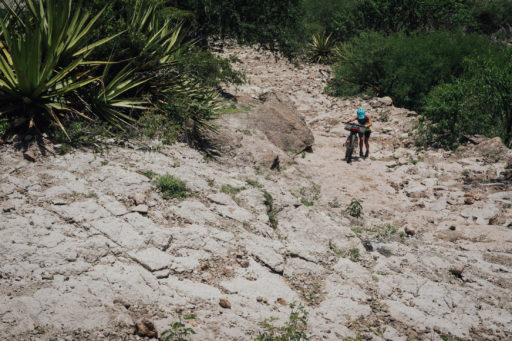
- Difficulty: This route is characterized by significant and sometimes steep climbing. Road surfaces are mixed but the terrain is never technical. Food and water are plentiful. Tackled in a clockwise direction, there’s one sizeable bike-push to note – the stint up towards San Jose del Pacifico, as marked on the map – which can take about half an hour of hard graft. If you’re coming from a coastal region, be aware that the ride hits up to 3000m in elevation. Be prepared for high temperates when climbing out of Santa Maria Zoquitlan, especially in the dry season. Be sure to hydrate and time your riding accordingly to avoid midday highs. Whilst it may be tempting to crunch big days, this is also a rides that suits a more mellow pace, simply because there’s so much to see along the way, especially when heading out and back into the city.
- Safety: Generally speaking, the mountains of Oaxaca are a safe place to travel through, but it’s always worth seeking up-to-date information locally and taking extra care within the capital. While it doesn’t effect this route specifically, there have been increasing reports of robberies in Oaxaca de Juárez, both in the city centre at night and on a few of the local trails during the day. If you’re out late, take a taxi home. In terms of riding, hiking, and running in areas close to the city, be especially mindful in Cerro del Fortín, the cross at Torre de Microondas, and at the wall at very top of the Libramento Norte – before the road drops down in Viguera, as used by some of our bikepacking routes and day rides into the Etla Valley. Problem zones are marked on the map under Safety in Oaxaca here where you can find more details.
- Critters: There can be mosquitos, black flies, and occasionally poison ivy, so packing some Benadryl if you’re sensitive to any of these can be useful. We’ve spotted brown recluse spiders too, as well as rattlesnakes, so an enclosed tent is recommended.
- Dogs: Mexico is overrun with street dogs so you can expect to find them loitering and lounging in the shade in Oaxacan towns and villages. Some of them are more vocal than others (bring ear plugs if you’re camping!), and others like nothing more than to take up chase! To fend them off, best practice is to either pretend to throw a rock or make a tzztzztzz sound. That’s what the locals do and it works well!
- Money matters: Aside from in Ocotlan, there are no ATMs en route, so bring enough cash to tide you through. Break 500 peso notes into small bills in one of Oaxaca’s banks beforehand, as small stores and restaurants will have trouble changing them.
- For general information about our extensive route network in Oaxaca, be sure to check out our Oaxaca Bikepacking Routes Network resource, with a Spanish translation coming soon. It includes details on getting there, bike shops, rentals, gear choices, food, arts and crafts, and worthwhile places to visit in the city and surrounding towns.
- Dispersed camping is possible along this route. I’ve marked a small selection of flat, unfenced areas on the map but with a keen eye there are plenty of others – especially in the more forested parts of the ride. Bear in mind that they are mostly unofficial spots, so be discreet and respectful, camp late and leave early, and above all be sure to leave no trace. If in doubt, ask for permission from the local ejido or village, as people are invariably very friendly and accommodating. Just note that if you end up camping in a populated area, bring your ear plugs to fend of a soundscape of fire crackers, barking dogs, and music … The Mexican countryside is rarely silent!
- Fuel: I use an alcohol stove and have marked up a hardware store on the map where you can can find alcohol industrial – next to La Michoacana on Calle de Frey Bartolomé de las Casas, which is near the Zocalo. It can be bought in bulk (56 pesos for 1.5L, ask for alcohol metilico). Elsewhere on the route, ask for alcohol puro or alcohol de quemar – be aware that it can be time-consuming to track down, so you’re likely better buying enough for the whole loop. Cleaning stores and pharmacies often stock more expensive alcohol etílico, make sure it’s a higher enough alcohol percentage, ideally 96% or so. Some burns better than others. You can also buy compressed camping gas bottles at La Gran Montaña. It’s on Miguel Hidalgo, close to Marito and Mogli Cafe, a hip little coffee shop that’s worth popping into if you need an afternoon pick-me-up.
- Most larger settlements will have lodging. In Miahuatlán de Porfirio Díaz, Hotel Diamante Plaza comes recommended.
- There are plenty of options to be found in touristy San José del Pacifico to suit all budgets. It lies before the halfway point of the route and is a great place to spend a mellow morning off the saddle, or even an extra day. Note that less touristy options can be found further up the hillsides from the main thoroughfare, and nearby San Mateo Río Hondo promises off-the-beaten-track alternatives too.
- Refugio Terraza de la Tierra. If you’re looking for something a little alternative, he beautiful Refugio Terraza de la Tierra offers rustic and well-priced cabins, a yoga hall, vegan fare, and some idyllic signed walks through the cloud forest. Those on a budget can camp in the organic vegetable gardens for 100 pesos per tent, though note that space is limited. It’s a short but steep descent to get down there… which means a sharp climb to get out. Food is available, though considering its location, bring your own too, especially if you have a big appetite. The grounds include a wonderful little trail to the Arbol de la Luna. The Refugio is great spot to spend a rest day, or a leisurely morning.
- Mitla side trip: To eek out your trip and visit the Mitla archeological site (and the excellent Tlacolula Sunday market, the day coincides), consider treating yourself to a night at the fantastic Casa Lyobaa ($85, 10 per cent discount for bikepackers paying cash). It comes complete with a beautiful cactus garden, a great breakfast, an excellent record collection, and a swimming pool! Otherwise, there’s plenty of more budget-minded accommodation to be found. This RWGPS track is a fun way of getting there, and will keep you off the highway the whole way.
- There’s a wide variety of accommodation available within Oaxaca City, from budget hostels to fancy digs. If you plan on setting up a base camp to explore the area in more detail, Air B&B can be a good option. Location-wise, it’s hard to go wrong anywhere near the centre of the city, with Barrio de Jalatlaco being an especially popular spot. A little further out is Barrio de Xochimilco – it’s the oldest part of Oaxaca and is also artistic, colourful, and crammed with coffee shops. Drop me a line if you are in town and want to meet up for an early morning ride!
- Even small settlements have simple tiendas – the major ones are marked on the map – so there’s no need to carry too much food at any one time.
- Many villages and towns have great local restaurants, offering have tlayudas, memelas, quesadillas, or tacos. In short, you won’t go hungry on this tour. We’ve marked a few favourites on the map. If you don’t want to bring your stove, bring a re-usable container for take-outs, like a Stasher bag or some stout zip lock bags.
- You’ll want to carry at least a few bottles of water with you. Depending on the season, I’d recommend having the capacity to run around 3-4L, as campsites will invariably be dry. When you stop in restaurants, ask to fill your bottles and offer a few extra pesos, to save buying plastic ones. Otherwise, you can refill all your bottles at the start of the day from a 20L, re-usable water jug (called a garrafon, approx 25-30 pesos) found in many local stores. This works out especially well if you’re 2 or more riders – although they’re larger than you’ll need, they’re both an economical and eco-friendly way of filling up.
- Bring a filter for mountain streams, too.
- In terms of regular markets, there’s the Sunday market in Tlacolula, the Monday market in Teotitlan, the Thursday market in Ejutla, and the Friday market in Ocotlan, amongst others. Find more about market days here.
- If you want to change things up in San Jose del Pacifico, check out Tatso, a fantastic Asian fusion restaurant, with lots of vegetarian and vegan options.
- For more about Oaxacan food and drink, and restaurant recommendations in the city, see our detailed Comida Oaxaqueño: Oaxacan Food Guide!
Day Rides and Route Alternates
Dirt Road Day Rides
Indeed, the three main valleys that prod out of the city offer much more than just riding… though cycling is definitely the best way of discovering them! With this in mind, we’ve included five recommended day rides of differing lengths to bookend your trip. The first and second will introduce you to the archaeological site of Monte Albán, one of the most important cities in Mesoamerica – one is a day ride and the other just a couple of hours in the saddle. A third hurdles the Libramento Norte, leading riders out on quiet dirt roads to the acclaimed Centro de las Artes de San Agustín, returning via the Zona arqueológica de San José El Mogote and the old railway line. In case you didn’t stop in Teotitlán del Valle on your way through the Mitla valley, a fourth overlaps the route briefly, using the mostly mellow foothills trails that connect the city with Huayapam, a village known for its pre-hispanic energy drink, tejate. The fifth is one of my favourite half-day rides in the area. It strikes out to San Felipe Tejalapam on ridgetop dirt roads, offering a fresh perspective of the area. Find links below and see Trail Notes for additional details about these routes, or visit my accompanying blog for a roundup of these rides, and much more – Still Out Riding.
1. Monte Albán and Cuilapan Rural Ramble
2. Monte Albán and Atzompa Rough ‘n Ruts!
3. San Agustín Etla: foothills out, railroad back
4. Teotitlán del Valle, via Huilapam, Dainzú, and Tule
5. San Felipe Tejalapam Dirt Loop (v. Roughstuff)
In addition to the various bikepacking routes to be found in Oaxaca (linked above), bookend your trip with dirt, gravel, and singletrack loops, rewarding ways of gaining a deeper understanding and appreciation of the area.
The Monte Albán and Cuilapan Rural Ramble is a challenging, roughstuff day ride that passes by the Zapotec ruins of Monte Albán en route to the Ex-Monastry of Cuilapam – a complex set in Oaxaca’s Valle Grande and Ejutla area. You can trim it down to the single loop, but I recommend the full figure of eight, as it’s a wonderful showcase for Oaxaca’s traditional farming practises and inter-cropping – a combination of corn, squash, and beans to help fortify the soil and keep pests away.
For a much shorter version with some short sections of trail, there’s also Monte Alban and Atzompa Rough ‘n Ruts. It’s a good little loop to see Monte Alban and Atzompa (currently closed), and get back into town with plenty of time to spare. Just note some of the trail may need to be walked, depending on rider confidence and bike setup. Either way, I recommend checking out Monte Alban! It’s an incredible Zapotec site and a highlight of visiting Oaxaca City.
Venture into the Etla Valley and visit the acclaimed Centro de las Artes de San Agustín, housed in a former textile factory, by following San Agustín Etla: foothills out, railroad back day ride. It connects rolling dirt roads to San Agustín with a former railway line on the way back, making for a nice variety of surfaces. There are singletrack options too if you want to spice things up.
If you rode the route clockwise and didn’t get a chance to check out Teotitlan del Valle and its beautiful textiles, then the 75km Teotitlán, via Hualapam, Dainzú, and Tule is sure to add great memories to your purchase. It links up predominantly mellow trails, rural roads, and remote two-track, via the archeological site of Dainzu.
And for a fresh perspective of the area, this short loop is a great way of getting out for a few hours, connecting dirt roads out to San Felipe Tejalapam, leaving you time to wander the streets of Oaxaca after lunch. There are several permutations to this – here’s my favourite.
Lastly… the full route includes an interesting and ‘unorthodox’ way out of Oaxaca. For those who want to save time, here is a shorter version, that is considerably more direct. It does mean riding the highway for a stint, however.
With thanks to Larry at www.oaxacamtb.com sharing his vast wealth of dirt road routes near Oaxaca City, from which much of my own knowledge is based.
Half day ride in San José del Pacífico
Tempted to spend more time in the cloud forest? Here’s a pleasant little half-day loop to the nearby village of San Mateo del Hondo, just in case you need extra validation for spending a second night in San José del Pacífico…
- Larry’s extensive website, Oaxaca MTB.org, is a fantastic local resource
- I keep a blog, Still Out Riding, with more ideas of bikepacking nature. Click on Oaxaca Bikepacking Info, in the top left corner, for thoughts on bike setups, day rides, and useful logistical info.
Terms of Use: As with each bikepacking route guide published on BIKEPACKING.com, should you choose to cycle this route, do so at your own risk. Prior to setting out check current local weather, conditions, and land/road closures. While riding, obey all public and private land use restrictions and rules, carry proper safety and navigational equipment, and of course, follow the #leavenotrace guidelines. The information found herein is simply a planning resource to be used as a point of inspiration in conjunction with your own due-diligence. In spite of the fact that this route, associated GPS track (GPX and maps), and all route guidelines were prepared under diligent research by the specified contributor and/or contributors, the accuracy of such and judgement of the author is not guaranteed. BIKEPACKING.com LLC, its partners, associates, and contributors are in no way liable for personal injury, damage to personal property, or any other such situation that might happen to individual riders cycling or following this route.
Please keep the conversation civil, constructive, and inclusive, or your comment will be removed.


