Mega Mid South
Distance
301 Mi.
(484 KM)Days
3-5
% Unpaved
95%
% Singletrack
0%
% Rideable (time)
99%
Total Ascent
15,578'
(4,748 M)High Point
1,222'
(372 M)Difficulty (1-10)
6?
- 3Climbing Scale Fair52 FT/MI (10 M/KM)
- 4Technical Difficulty Fair
- 7Physical Demand Difficult
- 3Resupply & Logistics Fair

Contributed By
Mid South Team
Guest Contributor
This route was created by The Mid South in Stillwater, Oklahoma: Bobby Wintle, Crystal Wintle, and Josh McCullock. The Mid South is a weekend endurance festival featuring two days of live music, food, multiple cycling distances, and an ultramarathon. You’re invited! Visit MidSouthGravel.com for details.
The Mega Mid South is a beautiful 300-mile route that comprises the outer perimeter of every Mid South course built over the past 13 years. The loop starts and ends at District Bicycles in Stillwater, Oklahoma, and traverses the tribal land of the Quapaw, Kiowa, Osage, Kickapoo, Pawnee, Iowa, Otoe-Missouria and Wichita Nations.
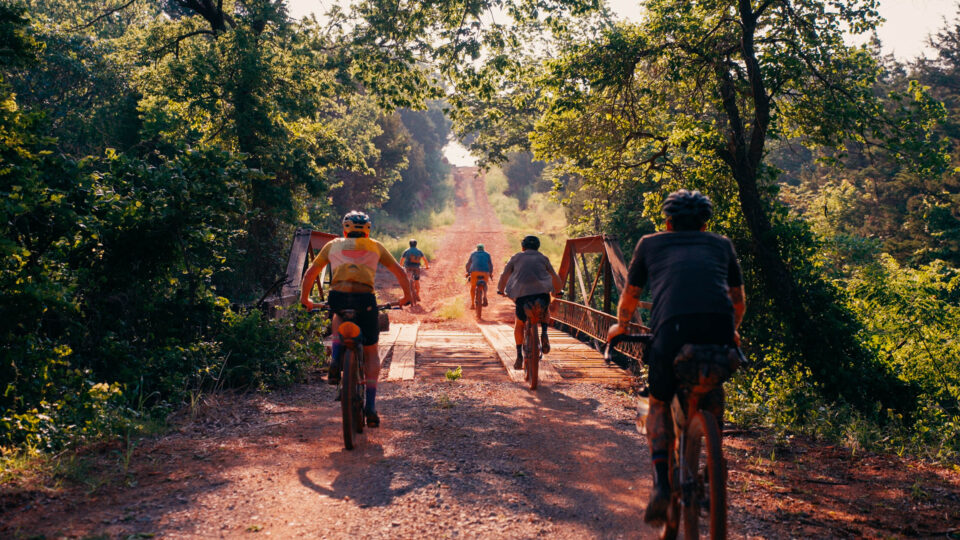
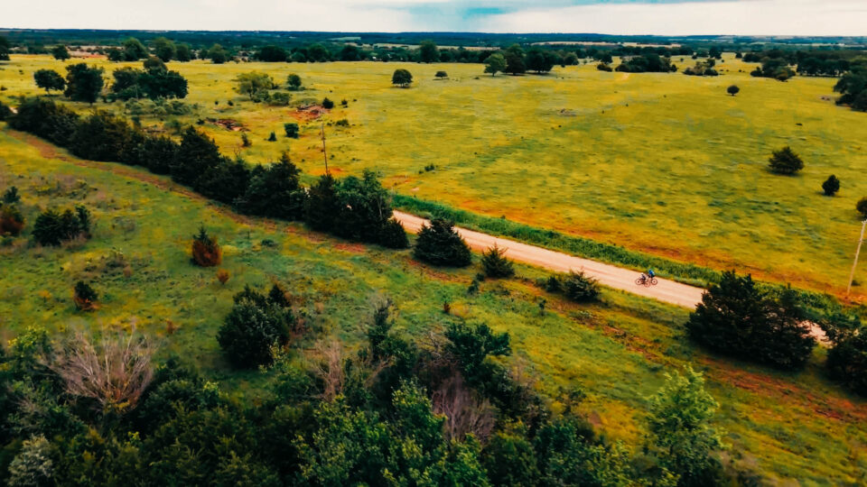
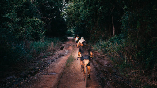
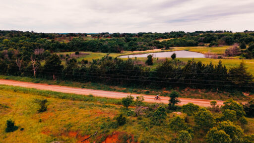
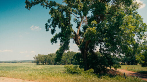
As with any Mid South route, there is much more than meets the eye as the endless red dirt rollers stretch across the Cross Timbers region of Central Oklahoma. The Cross Timbers is one of 12 distinct ecoregions in Oklahoma, stretching across the central and southern parts of the state. Due to the undulating terrain, much of this area has withstood the spread of large-scale mono crop agriculture that has taken over most of the state. You’ll spend your time riding among a mix of prairie and woodland with diverse flora and fauna. Dominated by post oak and blackjack oak trees, interspersed with tallgrass prairies, the Cross Timbers looks and feels very different than much of Oklahoma. The region was traveled in 1832 the famous American author Washington Irving. In his book, A Tour on the Prairies, Irving provides one of the earliest European accounts detailing the Cross Timbers. He called this area a “forest of cast iron,” alluding to the dense, nearly impenetrable thickets of oak and underbrush that he and his party encountered.
Geologically, these often rugged, rolling hills are ancient formations of sandstone, shale, and limestone. The sandstone, which you’ll see as outcroppings or protruding from the steep walls of the sunken roadbed, was formed from compacted sand particles over millions of years. These sediments were transported by rivers and shallow seas that covered this area during the Pennsylvanian period. These sand deposits were buried under additional layers of sediment, eventually forming the Sandstone we can now see after all these years of erosion.
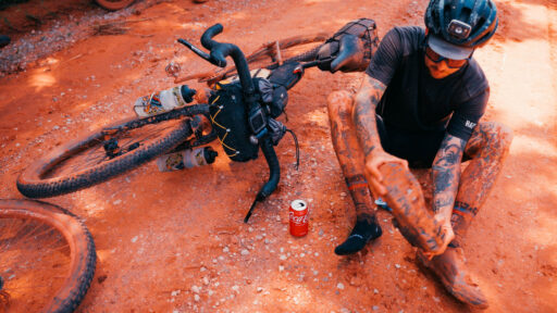
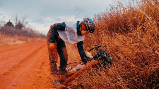
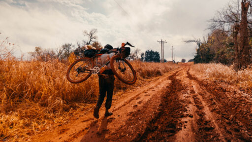
After just a few miles on the route, you may find yourself covered with the characteristic Oklahoma red dirt. This unique pinkish hue is created by the high levels of iron oxide in the soil. You’ll also notice a significant amount of clay in the roadbeds here, especially on the western half of the route. The clay soils are vey fine in texture, causing them to feel smooth and sticky when wet and have a hard, brittle texture when dry. Clay soil can hold an incredible amount of water. It’s heavy and very sticky after a rain. Just ask anyone who has competed in The Mid South on a wet year; they will probably have a story to share!
Culturally, the Cross Timbers region and more widely, the state of Oklahoma, has a rich and sordid past. The Pawnee, Osage, Caddo, Kaw and Wichita people were among the first to live in the region and rely on its resources.

With increased European settlement in the 19th century, the area became a cultural crossroads, including Native American, African American, and European American communities. The Indian Removal Act of 1830 forcibly removed tens of thousands of Native people from their ancestral homes in the southeast to “Indian Territory,” the land area now known as Oklahoma. This legislation resulted in mass suffering and loss of life due to the inhumane treatment during the removal. Even after claiming the treaty land promised to them before the removal, increased pressure from westward expansion dwindled Native land holdings, ultimately leading to allotment and the loss of over 90 million acres of Tribal land. Native American communities have endured significant cultural violence, disruption of life ways, and land loss in the time it took to establish Oklahoma as a state and continuing after statehood into the boarding school era. Even yet, Native communities are an integral part of our economy and community fabric within Oklahoma. Tribal governments and communities employ over 80,000 Oklahomans and contribute $9.2 billion to Oklahoma’s economy yearly. With 39 sovereign tribal nations headquarters within Oklahoma, it’s truly a unique place politically and culturally. We highly recommend a visit to the First Americans Museum (FAM) in Oklahoma City for a personal, immersive exploration of these histories, told by Native scholars and leaders. It’s well worth a visit!
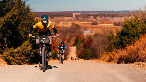
Come prepared for 300 miles of red dirt, B-road beauty with nearly 19,000 feet of climbing. These roads, though never too far from a friendly small town, feel remote and allow you to be totally immersed in the landscape. As ultra-endurance bikepacking routes go, Mega Mid South is fairly accessible, with multiple lodging and camping options, and C-stores never more than 50 miles apart. However you want to approach the route, you can know you’ll be able to resupply and rest when you need to.
Route Difficulty
Riders who have completed the route report that the first 100 miles are the most challenging due to the sun and wind exposure in the areas between Stillwater and Carney. Our recon rides have shown an average of 18,000 feet of total elevation, or approximately 60 feet of climbing per mile. Weather and road conditions will drastically affect the physical difficulty. If there is any sustained rainfall, much of the western side of the route could be impassable mud. Pace will also greatly affect the difficulty. Doing this route in three days will be far more challenging than breaking it into five days, even for a fit rider.
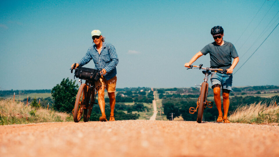
About 98% of this route uses dirt roads. These roads change with the weather, and vary from fast clay hardback, loose gravel over hardpack, deeply rutted dry clay, and even sand in some areas. While there is a feature climb on the route (“Brethren Hill” at mile 33), the bulk of the elevation gain is from the countless rollers within the Cross Timbers region. The most technical section of the route is “Gnarnia” at course mile 157. This one-mile section of unmaintained road may be overgrown and require some hike a bike. No problem!
The route utilizes the halfway point towns of past Mid South event routes, with a C-store or resupply option approximately every 30 miles. Camping and lodging are available in Guthrie, Lake McMurtry, Perry, and Pawnee.
Route Development: The original idea for the creation of this route came from our friend and local legend Dave Easley. During a long, delirious ride in the summer of 2023, he suggested we link together the outer perimeter of all the past Mid South routes. Seth Wood, another local legend and accomplished ultra-endurance competitor, contributed valuable insight on the route by helping us select the best roads to showcase the area. It took us a few months to ground truth the route, planning around Mid South 2024, but we finally pieced it all together and took two trips on the route in the fall and spring of 2024. You can watch the video series following the crew here.
Submit Route Alert
As the leading creator and publisher of bikepacking routes, BIKEPACKING.com endeavors to maintain, improve, and advocate for our growing network of bikepacking routes all over the world. As such, our editorial team, route creators, and Route Stewards serve as mediators for route improvements and opportunities for connectivity, conservation, and community growth around these routes. To facilitate these efforts, we rely on our Bikepacking Collective and the greater bikepacking community to call attention to critical issues and opportunities that are discovered while riding these routes. If you have a vital issue or opportunity regarding this route that pertains to one of the subjects below, please let us know:
Highlights
Must Know
Camping
Food/H2O
Trail Notes
- Enjoy downtown Stillwater before or after your trip. With great local cafes, restaurants, and breweries, you can enjoy your time in “Oklahoma’s friendliest college town.”
- Guthrie is a vibrant historical town, and Oklahoma’s first capital. Founded in 1887, Guthrie quickly grew following the Land Run of April 22, 1889, when thousands of settlers rushed to claim land in the newly opened “Unassigned Lands.” This area of approximately 3,000 square miles had originally been designated for Native American tribes but was left unallocated. Initially established as a tent city, Guthrie rapidly grew and was designated the territorial capital of Oklahoma. However, in 1910, the state capital was moved to Oklahoma City following a contentious vote. Guthrie also has a great gravel cycling scene, with riders gathering for “Guthrie Bike Night” every Thursday night to share miles on the dirt.
- Don’t miss the taco truck just before Lake Liberty!
- See Pawnee Nation headquarters, the hub of the Pawnee Nation, which oversees the administration of tribal government functions, cultural preservation, economic development, and environmental protections.
- If you camp near Lake Pawnee, you may see nesting bald eagles and the historic bath house. This 1939 WPA sandstone rock bath house overlooks a two-acre freshwater pool with a sandy beach, water slide, high dive, diving board, and paddle boats. It is open Memorial Day weekend through Labor Day weekend.
- Experience the Cross Timbers ecoregion of Central Okloahoma, where mixed hardwood forest meets expansive prairie in a sea of never-ending rollers. The transitional environments in the Cross Timbers support a rich variety of species, making it a crucial ecological region in central Oklahoma.
- If your trip allows, visit the First American’s Museum (FAM) in Oklahoma City, just an hour’s drive south of Stillwater.
- Two crossings of the Cimarron River, a 700-mile tributary of Arkansas River beginning in northern New Mexico.
- If you ride in the spring, you may time your passage with the blooming of the Redbud, the state tree. It has a heart-shaped leaf and bears tart, edible, lilac-colored flowers.
- Keep an eye out for wildlife on the route. You’re most likely to see white-tailed deer, coyotes, bobcats, wild turkeys, red-tailed hawks, northern harrier hawks, turkey vultures, and several species of woodpeckers.
- Key plants of the Cross Timbers region include post oak, blackjack oak, prairie grasses, and wildflowers, such as Oklahoma’s state wildflower, the Indian blanket.
- You will no doubt see the invasive Eastern Red Cedar. This tree quickly colonizes open lands, pastures, and grasslands, often outcompeting native grasses and altering natural ecosystems. When these trees become dense, they consume precious moisture in the prairie soil, which leads to a further reduction in biodiversity.
- Oklahoma weather is unpredictable. In general, we have our peak rainfall in the spring and early summer, with relatively mild winters. Early summer and fall are great times to attempt Mega Mid South if the forecast is dry. Late Summer can be very hot, with temps reaching over 100°F. Any considerable rain will turn the clay roads into heavy “peanut butter mud,” making efficient progress nearly impossible. This route will be incredibly hard to finish if there is any long-lasting rain.
- Oklahoma is “Tornado Alley”. We often have the possibility of severe thunderstorms or tornadic activity, especially in the spring and early summer. Make sure you have a bailout plan and stay weather-aware.
- The route is on open, rural roads. You’ll see farmers, oil field workers, construction crews, and locals on these roads daily. Large farm equipment and farm dogs will also be out there. Always be aware of your surroundings and be a friendly ambassador of cycling. The Stillwater cycling community values our relationship with our rural neighbors, so please be respectful.
- Both Stillwater and Tulsa offer airports and travel options.
- This route is 100% self-supported. No sag options are offered by District Bicycles or The Mid South.
- Camping is available at Lake Liberty, Lake McMurtry, Lake Perry, and Lake Pawnee.
- Guthrie, Perry, and Pawnee all have either a hotel, motel, or Air BBs for lodging.
- Camping at most public areas are self-pay. Please respect the local areas and pay at the honor box.
- Due to high levels of agricultural runoff and oil and gas activity, we do not recommend drinking or filtering water from lakes or streams.
- Always refill with plenty of water in each town you pass.
Sample Itinerary
Here’s a sample itinerary for a relatively quick “race pace”…
location Stillwater to Lake Liberty
Day 1 (100 mi +5,400 ft)
- Mile 28 – Hit the Cstore in Ripley Mile 65 – C store stop in Carney.
- Mile 98 – Stop for the taco truck at Lakeside or a cold beer at the Rock-a-Way Tavern.
- Cruise two more miles to camp and Lake Liberty and soak your worries away.
location Guthrie to Lake McMurtry
Day 2 (85 mi +4,700 ft)
- Mile 108 Breakfast at Katie’s Diner or Missy’s Donuts in Guthrie.
- Mile 146.7 – Option to deviate two miles off route to Cowboy Travel C Store for resupply.
- Mile 168 – Resupply in Perry.
- Mile 181 – Camp and resupply at Lake McMurtry. This is one of our favorite spots swimming, and riding singletrack. The bait shop has a small selection of snacks and drinks. Located just two miles off route mile 180. Visit this website below to book a campsite!
location Lake McMurtry to Stillwater
Day 3 (120 mi +5,700 ft)
- Breakfast at camp
- Mile 201 – resupply in Morrison.
- Mile 240 – swim then resupply at Pawnee.
- Mile 276 – resupply in Glencoe.
- Finish at District Bicycles!
Terms of Use: As with each bikepacking route guide published on BIKEPACKING.com, should you choose to cycle this route, do so at your own risk. Prior to setting out check current local weather, conditions, and land/road closures. While riding, obey all public and private land use restrictions and rules, carry proper safety and navigational equipment, and of course, follow the #leavenotrace guidelines. The information found herein is simply a planning resource to be used as a point of inspiration in conjunction with your own due-diligence. In spite of the fact that this route, associated GPS track (GPX and maps), and all route guidelines were prepared under diligent research by the specified contributor and/or contributors, the accuracy of such and judgement of the author is not guaranteed. BIKEPACKING.com LLC, its partners, associates, and contributors are in no way liable for personal injury, damage to personal property, or any other such situation that might happen to individual riders cycling or following this route.
Please keep the conversation civil, constructive, and inclusive, or your comment will be removed.


