Minnesota River Ramble
Distance
257 Mi.
(414 KM)Days
5
% Unpaved
68%
% Singletrack
0%
% Rideable (time)
99%
Total Ascent
8,273'
(2,522 M)High Point
1,063'
(324 M)Difficulty (1-10)
3?
- 2Climbing Scale Easy32 FT/MI (6 M/KM)
- 2Technical Difficulty Easy
- 3Physical Demand Fair
- 3Resupply & Logistics Fair
Contributed By

Scott Haraldson
Guest Contributor
During his time at university in Winona, MN, Scott discovered his love for the Driftless, and as a lifelong cyclist, it was a natural fit to combine his passion for camping and photography to tell stories of his biking adventures. For the past 15 years, Scott has worked in the customer service department at Quality Bicycle Products. You might have even had your portrait taken by him if you have ever “chased the chaise.”
The Minnesota River Valley is a unique and vital part of Minnesota’s natural and cultural heritage, offering a mix of scenic landscapes, ecological diversity, and historical significance. Riders will explore areas along the river, which flows through a valley carved by the Glacial River Warren—a massive river that drained glacial Lake Agassiz at the end of the last Ice Age, roughly 10,000 years ago. The erosion and sediment deposition from this ancient river created the valley’s distinctive landscape, characterized by its wide, flat-bottomed terrain and steep bluffs.
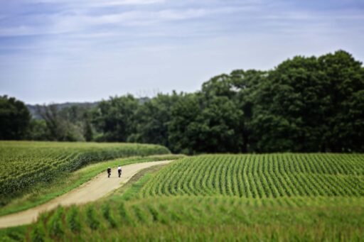
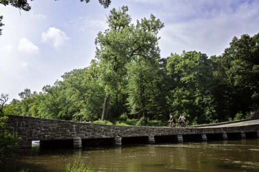
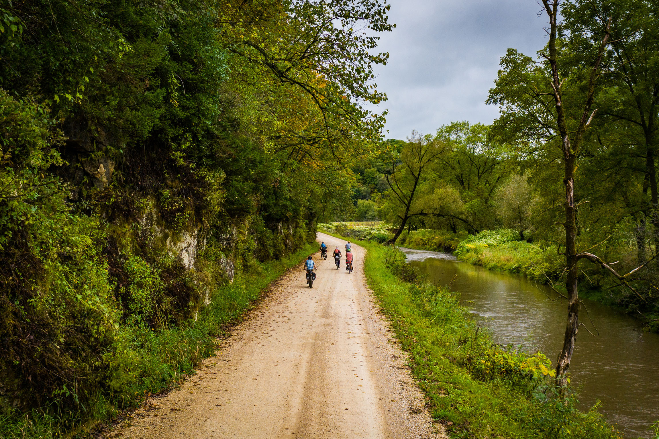
The Minnesota River Ramble allows bikepackers to traverse the area and experience this diverse terrain firsthand, from granite bluffs to waterlogged lowlands, along with expansive views of the valley and several waterfalls. The fertile soil of the Minnesota River Valley also supports important agricultural activities, with crops like corn, soybeans, wheat, and sugar beets divided by long stretches of gravel roads.
This region was also significant during the U.S.-Dakota War of 1862, a tragic chapter in Minnesota’s history that profoundly affected the Dakota people and other Indigenous people in the area. As the United States moved toward civil war, treaties and promises made to the Dakota tribes were largely broken and ignored, leading to starvation and economic hardship. In August 1862, the Dakota, provoked by these broken treaties and cultural pressures from reservation policies, decided to go to war with the United States. The conflict lasted six weeks, resulting in the deaths of nearly 500 white civilians and an unknown but significant number of Dakota. The war officially ended on December 26, 1862, when 38 Dakota men were hanged in Mankato in the largest mass execution in U.S. history. Afterward, the government forced most of the remaining Dakota to leave Minnesota.
Route Difficulty Paragraph
When viewed on paper, the route can appear relatively easy, with minimal climbing and an acceptable distance per day. What doesn’t show up on paper is varying gravel surfaces from hard-packed to very soft as well as sections of wide open fields with potential for unrelenting sun. We opted for July to accommodate our life schedules and were all consuming far more water than we normally carry, and the short but punchy climbs had us dripping with sweat.
The route includes solid logistics for camping, water, and food resupply, though take note of certain sections where food and water may be more sparse and make sure to plan ahead. All of the route is passable by gravel/touring bikes (we recommend 38mm tires at a minimum). Our group opted for tire widths of 700 x 40 (Salsa Warbird), 700 x 50 (Canyon Grizl) and 700 x 50 (Salsa Cutthroat).
Route Development
Having been born, raised, and lived my entire life in Minnesota, I set out looking for my next adventure in an area of the state where I hadn’t ridden before. Reviewing a map, my eyes drifted to the southwest and the blue line that represented the Minnesota River. Cross-referencing known gravel roads in the area, it became clear that a route that looped a section of the river would be possible. Taking into consideration that the group I travel with likes to enjoy taking time for breakfast and dinner, we settled on stretches of mostly 50-60 mile days, ending each night at an established campground.
A benefit of this route is that the narrow loop it creates allows it to be shortened to a four- or even three-day route by crossing one of the numerous bridges along the river and picking up the route on the other side.
Submit Route Alert
As the leading creator and publisher of bikepacking routes, BIKEPACKING.com endeavors to maintain, improve, and advocate for our growing network of bikepacking routes all over the world. As such, our editorial team, route creators, and Route Stewards serve as mediators for route improvements and opportunities for connectivity, conservation, and community growth around these routes. To facilitate these efforts, we rely on our Bikepacking Collective and the greater bikepacking community to call attention to critical issues and opportunities that are discovered while riding these routes. If you have a vital issue or opportunity regarding this route that pertains to one of the subjects below, please let us know:
Highlights
Must Know
Camping
Food/H2O
Trail Notes
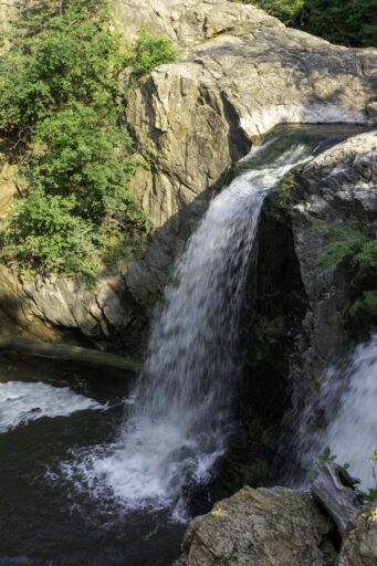
- Ramsey Park boasts two waterfalls, a trout stream, a swinging bridge, and even a small zoo. The first waterfall can be viewed from a long steel and wooden bridge that spans directly over it, offering a unique vantage point. The second, larger waterfall is just a short distance further up the route, cascading 30 feet into a wide, rocky gorge. A small bridge provides views from either side of the falls.
- Lower Sioux Agency Historic Site was established in 1853 by the U.S. government as the administrative center of the newly created Dakota reservation. The site’s history center features exhibits that explore the Dakota people’s story before, during, and after the U.S.-Dakota War. The site is managed by the Lower Sioux Indian Community.
- Granite Falls Pelicans White pelicans almost disappeared from Minnesota following the state’s settlement by Europeans, with no reported pelican nests after 1878 due to human persecution. Today, hundreds of these large white birds can be seen fishing in the turbulent waters below the dam in Granite Falls. You can watch them from the bridge or from the shore as they swoop down to catch fish going over the falls.
- Fort Ridgely State Park preserves the historic site of Fort Ridgely, a military outpost established in 1853. The park played a significant role in the U.S.-Dakota War of 1862, serving as a key battleground. Today, visitors can explore reconstructed fortifications and a museum that blends historical and natural attractions.
- Minnemishinona and Minneopa Falls are located near Mankato, with Minnemishinona being the first you’ll encounter. This waterfall plunges 42 feet into a sandy pool, with a steel and wood bridge above offering a direct view down to it. Minneopa Falls, located in Minneopa State Park, first tumbles over an 8-foot ledge before dropping nearly 40 feet into a beautiful gorge on its way to meet the Minnesota River.
- The Minnesota River is the primary highlight of the route. One of my favorite sections is in Vicksburg Regional Park, where you’ll find a boat launch. Look out into the river to see large granite outcroppings creating a significant eddy known as Deep Eddy, making the river appear to flow back upstream.
- Schell’s Brewery, the second oldest family-owned brewery in the nation, is located in New Ulm, Minnesota. The brewery features a lively beer hall and peacocks that roam the grounds. This was meant to be our final destination for celebratory beers, but a last-minute thunderstorm delayed our start from Minneopa State Park, and obligations back home rushed our finish.
- Best Time to Go: The ideal time to ride is late September to early October, when the fall colors are at their peak and insect activity is minimal. However, due to scheduling constraints, we rode in late July, encountering lot’s of sun, temperatures in the 90s and high humidity making us a sweaty mess, ripe for mosquitoes to atack us while setting up tents.
- Parking: We chose to ride the route clockwise, but it can also be done in reverse. We started in New Ulm to accommodate our drive from the Minneapolis area, aiming to be on the bikes by 9:30 am. Note that New Ulm does not have designated overnight parking lots, and street parking is subject to local ordinances. However, traffic enforcement mentioned that parking in the Cash Wise lot would likely not be questioned. We opted to park in the driveway of a friendly local who offered us a spot.
- Cell Access: Cell service is not reliable in all areas of the route, particularly in some campgrounds deeper in the valley. However, you should be able to find signal at various points throughout each day.
- Nicollet Bike Shop: Serving the greater Mankato area since 1971, Nicollet Bike Shop was originally located 3 miles south of Nicollet, MN. Shop owners Justin and Jenna Rinehart, both avid gravel cyclists, have since moved the shop to downtown Mankato. They can assist with any needs you may encounter before heading out.
- For a suggested itinerary highlighting key stops and dining options, check under the “Trail Notes” tab.
- Ramsey Park Campground offers modern amenities, including restrooms, water, and multiple shower rooms. There are power outlets available for recharging electronics at the nearby park pavilion. The tent area is small but provides several spots for setting up camp on a first-come, first-served basis. The town of Redwood Falls is a short bike ride away, offering food and drink options. The golf course is a convenient spot for a beverage and popcorn before heading back to camp.
- Granite Falls Memorial Park provides camping spots for both recreational vehicles and tents, with access to modern restrooms, water, and a single shower room. Campsites are available on a first-come, first-served basis, with RV spots located at the front and more private tent sites toward the back. There is also a larger group camping area available if the main camp is full. Power outlets for charging devices are located at the pavilion and shower area. The town of Granite Falls is just a short ride away, offering food and drink options.
- Fort Ridgely State Park offers a peaceful camping experience, with the option to fall asleep to the sound of Fort Ridgely Creek or choose a hike-in campsite for more privacy (and potentially more mosquitoes). Be sure to stock up on firewood before heading down the steep hill into the campground. Free showers and electricity are available.
- Minneopa State Park The name “Minneopa” means “water falling twice” in the Dakota language, referring to the two beautiful waterfalls of Minneopa Creek. The campground, located north of the falls up a short but steep climb, is a modern facility offering a mix of electric and non-electric sites, as well as a shower room. For those looking for a break from tent camping, there is also a camper cabin available for rent.
- I typically carry a few dehydrated meals, instant oatmeal, and coffee with me. There are enough restaurants and convenience stores along the route, so you don’t need to pack food for every meal. With proper planning, and being comfortable with gas station food, you could even skip bringing any meals from home if you prefer. For our five-day trip, I packed three breakfasts (days 2, 4, and 5), one lunch (day 1), and one dinner (day 3). We were able to eat at restaurants on other days.
- Water can be scarce, so make sure to fill up your bottles whenever you have the chance. I recommend carrying three bottles, depending on the time of year and how much you’re sweating, as there are sections without easy resupply points. Each campground has water available for cooking and to get you started each day. Lastly, don’t underestimate the kindness of locals; a friendly wave to someone in their yard and a polite “How’s your day?” followed by a request to use their hose can often result in a refill.
- Water Filtration There are plenty of streams and ponds along the route, but there is also a lot of agricultural activity, which raises concerns about farm runoff. I am hesitant to use this water but read up on your filtration system before you go.
- Grandview Winery This family-run winery started as a dream, with the father, mother and son seated at the kitchen table discussing the possibilities of what could be. Established in 2008 on land that’s been in the family for four generations, the winery now serves craft beer and scratch-made pizzas. Believe me, one pizza can feed three hungry riders. If beer and wine aren’t your style, they also have a cocktail lounge on the other side of the parking lot.
- The Korner: One of the best parts of bikepacking is visiting small local establishments, and The Korner in Morton fits that bill. It’s a great place to stop before camping at Fort Ridgely State Park. They have a full bar with a selection of tap beers, along with burgers, deep-fried foods, and pizzas. I recommend the bacon cheeseburger. Sit at the bar and chat with the staff or talk to the locals about what you have been up to. You can also grab beers to go from the off-sale liquor counter if you feel the reward is worth the effort to carry them the rest of the way.
- Rubi’s Kitchen Farm to Table Located in Redwood Falls, Rubi’s Kitchen is a great spot for dinner. After setting up camp, take the short ride up the hill into town to the old main street in town. Chef Rubi Kaufenberg focuses on farm-to-table dining, offering the freshest food directly from local farms. The diverse menu combines classic dishes with unique flavors from around the world.
- Casey’s General Store became our goto convenience store for the trip. Grab an electrolyte beverage, a breakfast sandwich, a Pearson’s nut roll or even a bundle of firewood to bring back to the camp. This is a premium convenience store and should be able to cover your resupply needs.
location New Ulm to Redwood Falls
Day 1: 52 miles, ~1,800 feet
Starting from New Ulm, you’ll head into Flandrau State Park, exiting via a gravel road at the park’s rear. While relatively short, be cautious on sections of paved road with limited shoulders; the gravel shoulders are solid and can be used safely. Enjoy the two descents into the river valley, followed by climbs back out. As you approach Redwood Falls, tuck in and make a straight shot across open farmland. Upon arrival, you’ll ride over the bridge crossing Chanshayapi River Falls but also take time to visit Ramsey falls before heading down to the campground to avoid an uphill return trip. Set up camp and explore the nearby town. For a post-ride drink away from mosquitoes, visit the golf course next to the campground, which offers beer, popcorn, and a spacious deck.
location Redwood Falls to Granite Falls
Day 2: 45 miles, ~1,300 feet
Enjoy one of the easier days on the route. Start the day by getting resupplies just off route at a convenience store in Redwood Falls, then head further upriver. Keep an eye out for a left turn on a big downhill around mile 13, leading to a mixed section of two-track and minimum maintenance road with several water crossings. At mile 21, stop by Grandview Winery for pizza and cold beverages, either on the back patio or in the air-conditioned indoors. If you’re interested in aviation, the Fagen Fighters WWII Museum is a short detour from the route and offers a place to refill water. Memorial Park Campground, just before Granite Falls, is a good spot to set up camp and shower before heading into town for a meal. Consider visiting Bluenose Gopher Public House or Jake’s Pizza.
location Granite Falls to Fort Ridgely State Park
Day 3: 61 miles, ~2,240 feet
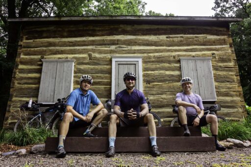
You’ll ride directly through Granite Falls so stop to grab a breakfast sandwich and a cup of coffee and take a moment to watch the pelicans gathering by the dam. This leg of the journey features some of the world’s oldest rocks, granitic gneiss dating back 3.8 billion years. Refill your water bottles outside an 1868 dovetail cabin in Skalbekken Park. A few miles later, you’ll descend into Vicksburg Park, offering more forested roads and close-up views of the river including a large eddy that makes the water appear to go back upstream. An optional extra mile brings you back to the river to check out a 1903 trestle bridge that once served gold miners searching for gold. Morton might be a stretch for lunch, but it’s worth it for a hot meal at The Korner. The day ends with a ride past the ruins of Fort Ridgely; take a moment to explore the remnants of the old military base. If you wish to have a fire grab firewood before dropping down into the river valley to the camp spots below.
location Fort Ridgely State Park to Mankato
Day 4: 66 miles, ~1,930 feet
The longest day of the route starts with a short potential hike-a-bike uphill out of Fort Ridgely. An extra 400 yards off route will provide a beautiful view of the valley. The route includes some short, steep climbs as you navigate towards gravel roads to avoid traffic. With few resupply points, make sure to fill your water bottles at the faucet behind St. George Church. The small town of Courtland is a great lunch stop; grab food and drinks at the Crow Bar, then restock supplies at the convenience store across the street. In Mankato, consider stopping for dinner at Pagliai’s Pizza and picking up any last-minute snacks before the final push to camp. When you reach Minneopa State Park, take the time to visit the waterfalls before heading to the campground, as the next day’s route continues further up the hill.
location Mankato to New Ulm
Day 5: 33 miles, ~1,250 feet
The final day’s route is shorter, allowing for some time in New Ulm before heading out of town. The morning starts with an optional ride along a grassy path following the fence line; keep an eye out for the bison herd, which has grown to 30-35 animals since its start in 2012. The path ends at the historic Seppman Mill. From there, you can either return on the trail or bushwhack through an overgrown trail back to the road. The route then continues with several sections of minimal maintenance roads as well as some very fun downhills and uphills, before finishing back in New Ulm at Schell’s Brewery.
Terms of Use: As with each bikepacking route guide published on BIKEPACKING.com, should you choose to cycle this route, do so at your own risk. Prior to setting out check current local weather, conditions, and land/road closures. While riding, obey all public and private land use restrictions and rules, carry proper safety and navigational equipment, and of course, follow the #leavenotrace guidelines. The information found herein is simply a planning resource to be used as a point of inspiration in conjunction with your own due-diligence. In spite of the fact that this route, associated GPS track (GPX and maps), and all route guidelines were prepared under diligent research by the specified contributor and/or contributors, the accuracy of such and judgement of the author is not guaranteed. BIKEPACKING.com LLC, its partners, associates, and contributors are in no way liable for personal injury, damage to personal property, or any other such situation that might happen to individual riders cycling or following this route.
Further Riding and Reading
Here are some connected/nearby routes and related reports...
Please keep the conversation civil, constructive, and inclusive, or your comment will be removed.


