Death Valley Dustup
Distance
250 Mi.
(402 KM)Days
6
% Unpaved
66%
% Singletrack
0%
% Rideable (time)
92%
Total Ascent
19,140'
(5,834 M)High Point
7,653'
(2,333 M)Difficulty (1-10)
7?
- 5Climbing Scale Moderate77 FT/MI (15 M/KM)
- 8Technical Difficulty Difficult
- 7Physical Demand Difficult
- 8Resupply & Logistics Strenuous
Contributed By

Kacey Frisher
Guest Contributor
Kacey is a trail worker with the park service where they get paid to live and work in the woods, mountains, and deserts of the American West. When they’re not building trails and their structures, Kacey’s usually out backpacking, trail running, or biking.
Additional photos by Summer Kniveton
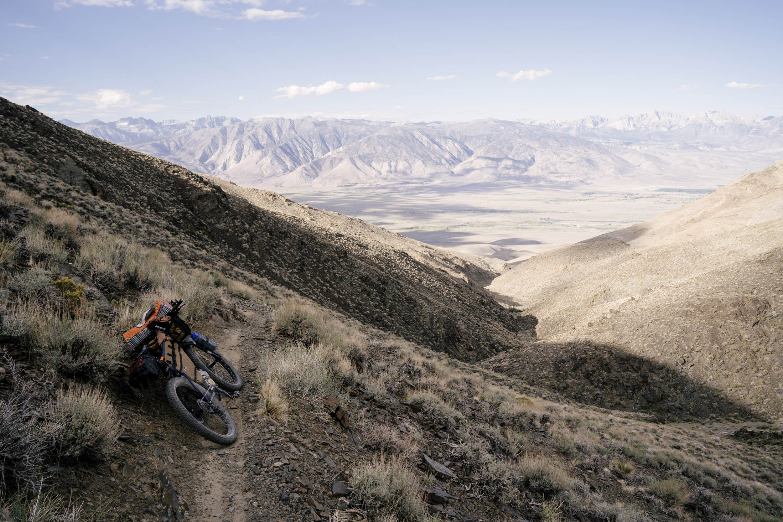
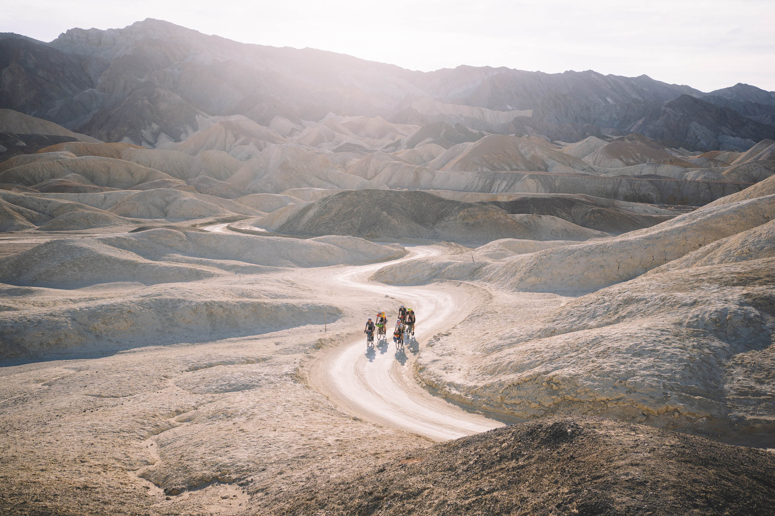
Death Valley is the largest national park in the contiguous United States, with over 2,000 miles of road, most of which are dirt. The northwest section of the park, where this route is located, is one of the least-visited parts, making it the perfect destination for bikepackers looking for a remote desert experience. Loosely a circumnavigation of the Saline Valley, this area features an extensive mining history from the turn of the century and a wealth of geologic wonders. High-elevation plateaus and two mountain passes bring unexpected flora in the form of pine forests and wildflowers, and low desert stretches will challenge with hot temperatures and rocky, sandy tracks. There are plenty of rewards to be had, though, including a mid-trip hot spring soak, a mysterious tub full of marbles, and a bunch of tea kettles.
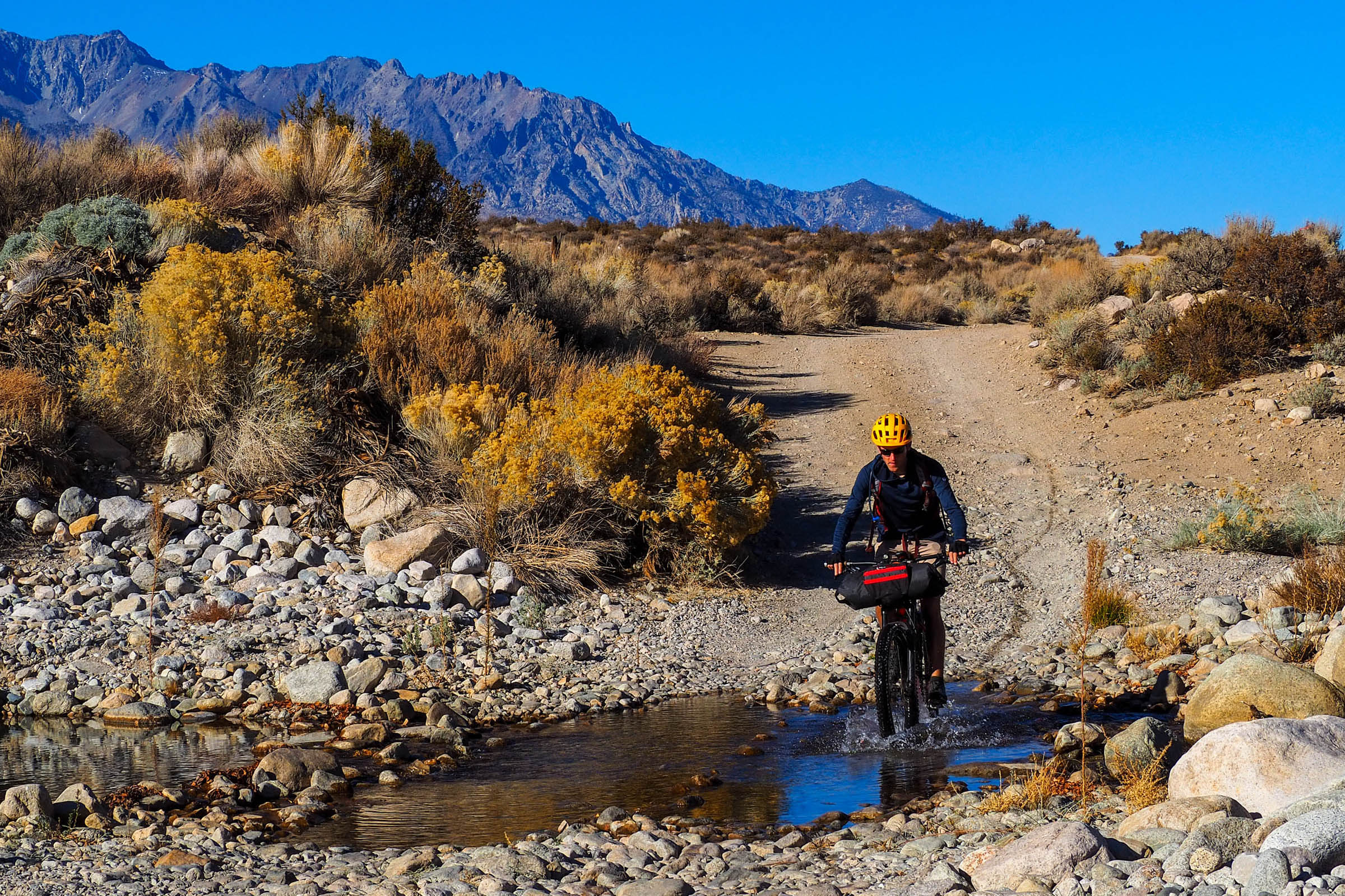
The route begins in the Eastern Sierra, where it parallels Highway 395. Expect towering views of the snowcapped Sierra Nevada to the west as you pass through quintessential mountain towns. In the Alabama Hills, the route passes through world-class rock climbing and the site of more than a few Western film sets.
Also along this corridor is the Manzanar National Historic Site. In stark contrast to the natural beauty of the surrounding valley, it’s where over 120,000 Japanese Americans were imprisoned during World War II. Through the atrocity, the people detained at Manzanar built a flourishing city and culture; the site today serves to honor them, interpret their history, and attempt to reckon with the ugly mark of our own. Though a heavy stop, I consider it necessary and recommend listening to Order 9066 to learn more before the visit.
To the east, this valley is flanked by the Inyo Mountains. Incredibly rugged, this range serves as the barrier to entry for reaching the Saline Valley. Luckily, two roads traverse it east to west to ease the ride. The route begins climbing on the southern end along the paved Highway 190 before cutting north into the park’s wilderness. As it crests the Darwin Plateau, begin to notice the Joshua trees that appear. These are indicators of the Mojave Desert, North America’s driest and hottest desert, which you’ve now entered.
Going north toward Lee Flat, the density and size of the Joshua trees increases, as does the likelihood of spotting a wild burro. These donkeys are not native and are descendants of domesticated livestock let loose or escaped (for this reason, many wildlife biologists will snarkily refer to them as feral). Climbing higher, riders arrive at Hunter Mountain, a perhaps unexpected biome in the middle of a desert named for its fatal severity. Here, riders can camp underneath towering pine trees, drink from gurgling springs, and maybe even throw a snowball, depending on the time of year.
After a fun and very steep descent (expect 15-20% grades), the route reaches Teakettle Junction, named for the tradition of leaving tea kettles on the sign. Shortly thereafter, riders pass the Racetrack. Until recently, scientists were unsure what caused the large rocks to sail across the surface of this white playa, leaving snail tracks in their wake. But never lacking a sense of humor, they named the area the Racetrack to refer to the boulders’ infinitesimally slow trek across the sand. In recent years, they’ve discovered that it is, in fact, a combination of rain, ice, and wind that slowly propels these rocks forward.
After another punchy descent down Lippincott Road, riders reach the lowest and hottest section of the route. At about 1,000 feet above sea level, this is still higher than the park’s lowest elevation at Badwater Basin, which also holds the national record at 300 feet below sea level. A hot and sandy ride across the Saline Valley will bring riders to the foothills of the Inyos again, where short detours up canyons reveal secret waterfalls and the ruins of past mining. Occurring some 25 years later than the famous mining rush in this state, laborers in the Saline Valley were instead mining for sodium chloride and borax. You may spot looming lumber structures along the edge of the now-dry lakebed; these towers are part of the historic tramway used to transport over 30,000 tons of salt across the Inyos in the early 1900s. The entire tramway, which includes a largely intact station and bunkhouse along the crest of the Inyos, is now on the National Register of Historic Places thanks to its status as the steepest tramway in the United States.
Relax at the Saline Valley Warm Springs. This clothing-optional hot spring has multiple constructed tubs in both the lower and upper sections, and there is even a chance to shower! Folks here are friendly, and many are longtime patrons of the springs. I recommend camping here to enjoy the full experience. Afterward, begin the long and sandy climb out of the valley. This is a slog, but you’ll be rewarded at the top with a visit to the Marble Bath. Referring to a geologic feature nearby, some pranksters with a sense of humor installed a clawfoot tub in the sand filled with marbles and rubber ducks. No water is to be found here, but feel free to scrub-a-dub anyway.
The descent down Dedeckera Canyon is sandy, rocky, and the most technical riding of the trip. Near the bottom of the canyon is a feature referred to by offroaders as “the waterfalls.” Again, there’s no water to be found, but these cascading rock shelves of about two or four feet might require some hike-a-bike, especially for riders without suspension. The next stretch to the Eureka Dunes is also sandy and will likely require dismounting. Again, this depends on your skill and tire width, but expect a bit more of a slog. The Eureka Dunes greet you at the base of this descent. Standing at nearly 700 feet tall, they are the tallest dunes in California and possibly North America. Many endemic plants are found at the base of the dunes, including rare primrose and milkvetch. This spot is especially magical when the sky illuminates the surrounding mountains at sunrise and sunset.
Shortly thereafter, you will reach Death Valley Big Pine Road. This paved east-west road is the exit out of Saline Valley and back into the Eastern Sierra. Riders will climb again into the juniper and pine ecosystem, but only after coasting through another dense Joshua tree forest. This forest is one of the northernmost ranges of the tree. The road has steep and sustained climbing but is eased by the pavement. From the crest of the Inyos, enjoy a fast descent back into Big Pine as the Sierra Nevada once again looms on the horizon.
Route Development
This route was developed shortly after thru-hiking Brett Tucker’s Lowest to Highest route across Death Valley in fall 2021. Enamored with the landscapes we crossed and eager to see those we didn’t, I began scheming a route to connect the Saline Valley warm springs with some other off-the-beaten-path sights included in this route. Feedback from my friend @glittergravel, who lives nearby, was crucial, as was the input of Death Valley National Park rangers. Immense gratitude to my friend Summer Kniveton, who rode the inaugural scouting mission with me in the spring of 2024 and without whom none of our incredible adventures would be possible.
Submit Route Alert
As the leading creator and publisher of bikepacking routes, BIKEPACKING.com endeavors to maintain, improve, and advocate for our growing network of bikepacking routes all over the world. As such, our editorial team, route creators, and Route Stewards serve as mediators for route improvements and opportunities for connectivity, conservation, and community growth around these routes. To facilitate these efforts, we rely on our Bikepacking Collective and the greater bikepacking community to call attention to critical issues and opportunities that are discovered while riding these routes. If you have a vital issue or opportunity regarding this route that pertains to one of the subjects below, please let us know:
Highlights
Must Know
Camping
Food/H2O
Trail Notes
Resources
- Steep and fast descents down Hunter Mountain and Lippencott Rd
- Soak in Saline Valley warm springs mid-trip when your muscles need it most
- Weird and wacky desert inside jokes like the Marble Bath and Teakettle Junction
- Experience some of the most isolated parts of the Lower 48’s largest park while biking through stark desert wilderness
- Endemic wildflower blooms if you ride in spring
- World-class stargazing
- The tallest sand dunes in North America at Eureka Dunes
- Grab a hearty breakfast at Alabama Hills Bakery & Cafe
- Support Native-owned business at Brewed Awakening
- Watch the snail-paced race of boulders across the Racetrack and witness other geologic delights
- Typically, the route will be rideable from mid-March to mid-April and again from early October to early November, though fall will be drier. Two high passes that regularly receive snow combined with low and hot biking out of Saline Valley make the season for this route short and strenuous. Riders may encounter snow, temperatures over 90°F, or both! I recommend calling rangers ahead of time or checking out the comments on Saline Preservation Association‘s discussion board to get a sense of conditions.
- Parking is available at the Museum of Western Film History in Lone Pine for $5 a day or $25 for the week. We parked at Mendenhall Park in Big Pine without issues. Roadside parking is also allowed anywhere within the park if a valid park pass is displayed in the windshield. The pass costs $30 for the week and can be purchased at any ranger station. Alternatively, display an annual National Park Pass, which costs $80 and is valid at all national parks for a year. Make sure to let rangers know your plans as vehicle abandonment is a big issue in the park.
- Which bike? Much like the ideal season for this route, the best tire is also a bit of a goldilocks. Less than 2.5″ will have you suffering through the sandy sections, but a fat bike is likely overkill due to the long pavement stretches crossing the Inyos. Though a skilled rider could manage this route on a rigid, front suspension will be much more comfortable, especially on chunky, loose, and steep descents.
- Do not expect to have cell service anywhere on this route outside of the stretch from Big Pine to Lone Pine. There is zero service within the park, so I highly recommend bringing an emergency beacon or satellite device.
- This route is best ridden counterclockwise. This avoids the gnarly hike-a-bikes we encountered up Hunter and Lippencott. While this direction entails a gradual sandy seven-mile climb out of Saline Valley, it occurs later in the trip, so riders can expect lighter rigs. This direction also means the longest dry stretch (60 miles) occurs over a net elevation loss instead of gain.
- Know the signs and symptoms of dehydration and heat injury! This route is no joke when it comes to sun exposure. Combined with limited water sources, the risk of heat injury is high. I don’t recommend this route for those new to desert bikepacking. Riders will want a strong understanding of water and heat management to avoid dehydration or worse.
- Carry at least six liters’ water capacity and ideally eight. Assuming a water cache at Eureka Dunes, the longest stretch without water is 57 miles and includes a dry camp.
- There are limited bailout options once riders cross into the park. The extreme remoteness of this route is its best and worst attribute. Should something happen, expect to be on your own.
- I highly recommend slackpacking the section between Big Pine and Lone Pine. If you’re able to arrange a car shuttle, it’s possible to ride a near-empty rig the 55 miles between towns in the Eastern Sierra. Grab your stuff to camp in Lone Pine and pack up before biking out the next day.
- Deep sand. Typically, the section north of Saline Valley Warm Springs is worse than the southern half, but because of the extreme weather, this park changes on a near-annual basis. Either way, be prepared for deep sandy sections almost daily. Combined with the steep climbs, that reduced our daily mileage by about 35% of our typical speed.
- Kastle and her husband Jon own and operate Elevation Sierra Adventure in Lone Pine. Though more geared toward hikers and backpackers, they have a few last-minute emergency supplies, including bike tubes, patch kits, and a toolkit, which they’re always willing to share. If you decide to slackpack the Eastern Sierra section, they are also exceptionally kind about storing gear/food. Other bike shops are located north of the route in Bishop.
- Manzanar Historic Site is an extremely worthwhile visit. Though the grounds are open and have self-guided tours daily year-round, the visitor center is only open Friday to Monday from 9 a.m. to 4:30 p.m.
- It’s best to bring lights for the three paved stretches. There is an unavoidable section along Highway 395. Though the shoulder is wide, cars drive very fast. Stay alert and exercise caution when crossing. The ride out of Lone Pine on Highway 190 is the main throughway across Death Valley and can be busy and fast. If faced with a headwind, consider skipping if you’re not a purist and have the ability to shuttle cars. The climb and subsequent descent over the Inyos into Big Pine is also paved but much quieter.
- Permits are not required, but it’s recommended to let the rangers know your itinerary. You can do so by stopping by in person at the Furnace Creek or Stovepipe Wells visitor centers or giving them a call at (760) 786-3200.
- The Whitney Portal Rd was washed out when we biked it. This required a short hike-a-bike. I expect the road to be repaired soon, so keep an eye out.
- Free roadside camping is allowed anywhere in Death Valley as long as riders are more than 1 mile from the nearest road junction and more than 100 yards from water sources. Exceptions include the 9.5 mi stretch between Teakettle Junction and Homestake Dry Camp, Saline Valley warm springs, Eureka Dunes, and along Big Pine Road.
- “Dry” camps can be found at Homestake and Eureka Dunes. These developed campsites are free, first-come first-serve, and have no services besides pit toilets.
- Saline Valley warm springs is a magical oasis in the middle of the desert. The free first-come first-serve space is separated into the lower and middle springs. Old-timers say that the lower springs are “fancier” – the campground host resides there, there’s a library and even a lawn. The middle springs are comparatively underdeveloped. This is a clothing-optional area though showering before entering the tubs is not. There’s also water available here but note that it is not technically potable according to the park and some visitors report feeling sick.
- There are a number of campgrounds between Big Pine and Lone Pine run by Inyo County including Baker Creek, Tinemaha Creek, Taboose Creek, and Independence Creek. Sites cost $14 per night (unfortunately there is no bike-in discount) and vary in terms of amenities offered. Many of the campgrounds also turn off water for winter. Though it’s possible to reserve in advance online, most of the campgrounds we saw were empty in the shoulder season.
- There’s abundant free dispersed camping in the Alabama Hills just outside of Lone Pine. PLEASE PACK OUT YOUR WASTE in this heavily visited area or use one of the 6 pit toilets spread throughout the area.
- Affordable lodging is available in Lone Pine at the Mt. Whitney Portal Hotel & Hostel.
- Water is perhaps the most challenging aspect of this route. Though abundant on the Eastern Sierra side while paralleling 395, it is virtually non-existent within the park.
- The only reliable water sources in the park are at Hunter Mountain, Hunter and McElvoy Canyons, and Saline Valley warm springs.
- This makes water caching ahead of time a near-necessity. I recommend caching water at Eureka Dunes, 51 miles from Big Pine on mostly paved roads. Note that google map will not route you correctly if you just enter Eureka Dunes as the destination, but this route is driveable. If you’re not feeling up for the 2 hr round trip detour, caching water en route along Big Pine Rd at the Saline Valley OHV trailhead is also helpful.
- You may also want to consider caching water at Teakettle Junction. This, however, is nearly a 4 hr detour each way from Lone Pine and Big Pine so perhaps only practical if coming from the east. As with biking, be prepared to be self-sufficient when driving the roads in Death Valley as very few companies will assist with towing.
- I found the Saline Preservation Association’s discussion board to be extremely helpful in coordinating water drops since many of the visitors off-road to the springs.
- Jackass Springs on Hunter Mountain is slightly off the road. It may require some searching or digging out, but the spring is reliably present year round.
- There are some cattle troughs along Saline Valley Rd going towards Hunter Mountain. These should ONLY be used in an emergency and may be empty.
- Food resupply is extremely limited. For the entirety of the route within the park, expect no amenities.
- Lone Pine Market serves as the sole grocer on this route. Expect typical gas station finds in Big Pine and Independence.
- Brewed Awakening is a native owned coffee shop and cafe in Big Pine that serves excellent coffee with a surprisingly robust food menu. Closed Sundays.
- Alabama Hills Cafe and Bakery opens at 5 a.m. (closed Wednesdays) so there’s no excuse not to visit. Start with a hearty breakfast and grab one of their baked goods to go.
Eastern Sierra
Heading south from Big Pine, the route gradually loses about 3,000 ft as it parallels Highway 395 through the foothills of the Eastern Sierra. The powerline road along Crater Mountain Wilderness area is rough- lots of up and down with large, loose rock and sandtraps at the bottom of nearly every descent. After 10 mi, the riding improves as riders descend to a well-graded gravel road. After a brief stretch of riding on 395, arrive at the community of Independence where a lone gas station offers water and snacks. Shortly after, riders reach Manzanar where a lone white marble tower stands watch over the site.Marking the camp cemetery, the obelisk was carved by an incarcerated stonemason. A replica sign nearby reminds visitors of the heavy surveillance the internment camp’s more than 10,000 residents lived under and the small geographic area of their confinement.
Just south are the Alabama Hills. Cruise through this popular climbing area on smooth gravel roads while enjoying the cinematic scenery – so cinematic that it’s been the backdrop for more than 400 films including everything from John Wayne shoot ‘em ups to Django Unchained. If camping in the area, I recommend the short 0.6 mi hiking loop to the Moibus Arch.
For those short on time, a far less pleasant alternate is to take highway 395. Though it only cuts off about 10 miles, the pavement tends to go much faster.
Hunter Mountain
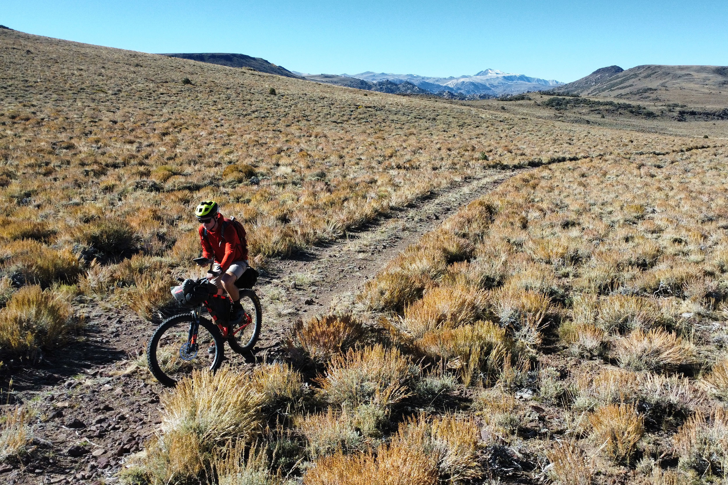
The first 35 mi out of Lone Pine are an unfortunate paved road climb. There are often nasty headwinds on this section and unless riders are purists about completing the route as written, it’s worth skipping. Cutting north on Saline Valley Rd, a mix of deteriorating pavement and good gravel gently climbs up the Darwin Plateau until riders reach Lee Flat. Here, expect to find multi-story Joshua trees interspersed with wild burros and cattle.
Over the next 9 mi riders gain 2,400 ft in the first major climb of the route. The views south into Panamint valley make it worth it as the road curves around the hillside. As the ecosystem starts to shift from the low desert into pinyon and juniper trees, riders may find good campsites nestled among the trees and cattle troughs full of water if there’s been recent rain. If riding shortly after snowmelt, there may also be muddy patches. Luckily the mud does not tend to be sticky, though riders may feel more like they’re racing cyclocross than gravel biking through the desert.
There are two springs here: Jackass Spring is downhill from a beautiful campsite overlooking the valley. In bad weather, a 0.7 mi spur will take you to the historic Hunter Cabin though beware of hantavirus.
Teakettle Junction and the Racetrack
The descent off Hunter Mountain is fun and steep, losing more than 2,100 ft in 7 mi, but also marks the start of a 57 mi dry stretch. Though a net elevation loss, be prepared with plenty of water. Dropping into another valley full of Joshua trees, this section felt like the most remote of the whole trip. Very few people drive Hunter Mountain Road, and, with Hunter Mountain behind and the Cottonwood Mountains ahead on the horizon there’s nothing but wilderness within sight. By far this was my favorite portion of the route.
Next riders reach Hidden Valley. This is another hidden gem of Death Valley. There’s not quite enough words to describe the dry lake bed surrounded by peaks. A devoted Death Valley volunteer told us on our trip that this was his favorite part of the entire park, but I think it has to be seen to be understood. After a short descent, riders reach Teakettle Junction where it’s customary to leave a kettle on the sign.
Another gradual descent brings riders past the Racetrack, a once mysterious playa where the boulders glide across leaving trails in their wake. Most of the (glacially slow) “action” happens on the southern end of the playa. It’s worthwhile to ditch the bike for a bit and take a walk around. Note that bikes are NOT allowed on the Racetrack.
2 mi south is Homestake Dry Camp. This small campground nestled at the base of an unnamed drainage has 9 sites and a pit toilet. In spring, wild primrose, globemallow, and other wildflowers bloom around the sites. There’s a 2 mi roundtrip detour to historic mining ruins from here, worthwhile if riders have extra time, though we were too exhausted to explore.
Saline Valley warm springs
The descent down Lippencott loses over 2,000 ft in just 4 mi. Expect steep grades but surprisingly good gravel with the occasional large loose rock. We, unfortunately biked (hiked) up this road but frequently joked that it looked like the road to Mordor. This is the steepest and most fun descent of the entire trip.
Once riders reach the valley floor, they’ll parallel the dry lake bed for 19 mi before turning off for the hot springs. Though a gradual descent, this section is brutal. Expect extremely loose and sandy roads combined with zero coverage from sun exposure. It’s best to avoid this section during midday due to its low elevation; we took to hiding in the creosote bushes every 15-30 min while we rode.
As the road creeps closer to the foothills of the Inyos, riders may notice water running across the road. This depends on recent weather conditions and should not be counted on. Walking up canyon at Hunter or McElvoy will bring riders to reliable water – how far up canyon, like with water running on the road, is weather dependent. We hit water in Hunter Canyon just 0.5 mi up, though the entire trail is 1.1 mi each way. McElvoy canyon is farther at 3 mi roundtrip with nearly 1,000 ft of elevation gain. Though both side trips appear as roads on the map, they are best completed on foot.
One more short climb brings riders to Saline Valley Warm Springs, a palm-lined oasis in the desert.
Eureka Dunes
A 20 mi climb out of Saline Valley, though mostly gradual, feels interminable due to very deep sand the majority of the way. When we rode it downhill, despite a nearly 3,500 ft loss, we had to constantly pedal. Just before the crest of the climb, riders reach an unmarked pullout on a switchback. A short walk will lead them to the marble bath. Unknown and extremely committed pranksters, noting the nearby location of a geologic feature named the marble bath, sunk this clawfoot bathtub into the sand near a rock overhang and filled it with blue marbles and rubber duckies. Worth a soak.
The next valley above Dedeckera Canyon rolls through more hills as it gradually descends to the canyon mouth. Hyped by many as “the WORST part of the route!!” we were pleasantly surprised by the road quality here. Though a few sandy sections, it was mostly rideable. The waterfalls are a series of 3 sheer rock drop offs of 2-4 ft that require hike-a-bike or more mountain bike skill than I have. The section riding around the Eureka Dunes is also extremely sandy and will likely require dismounting. But riders can marvel at the Last Chance mountain range now towering to the east and the variety of fascinating geologic features within it. Camping here is restricted to the dry camp on the north side of the dunes. Especially sublime at sunrise and sunset, riders with energy may want to climb up the 700 ft dunes.
Inyo Mountains
The final climb of the trip is stout at over 4,600 ft in just 23 mi but luckily the majority is paved. Climbing out of Saline Valley riders will pass through another dense Joshua tree forest. This was previously thought to be the northernmost edge of their range until another population was found just a few miles north in the White Mountains. Shortly after, riders will once again enter pinyon pine and juniper country. It’s almost over now. Upon reaching the sign for Wacouba Saline, the climb is over. Now riders descend nearly as much back into Big Pine.
Alternates
Riders wishing to shorten the route may cut off the section across Hunter Mountain to Teakettle Junction and the Racetrack by continuing NW on Saline Valley Rd. This alternate descends 10.5 mi to meet up with the main route compared to 41 mi and is a good option for those short on time or with limited water capacity.
Another option for riders who are less comfortable with remote desert riding is to exit via Teakettle Junction to Ubehebe Crater and continue north until the road meets up with Big Pine Rd. This option is 55 mi and gains 5,100 ft of elevation. Though it misses the hot springs, marble bath, and Eureka Dunes, Ubehebe Crater is a destination in its own right and the paved section north plus increased proximity to services like developed campgrounds and a ranger station may be a better fit for novice desert bikepackers. This alternate bypasses 83 mi of the original route.
Additional Resources
- I cannot emphasize enough how helpful the members of the Saline Preservation Association’s forum were in gathering conditions reports, assistance with water caching, and information about road status. Highly recommend perusing before your trip.
- Order 9066 is a fantastic podcast about the history of America’s Japanese concentration camps during WWII and a helpful listen if you decide to visit Manzanar.
Terms of Use: As with each bikepacking route guide published on BIKEPACKING.com, should you choose to cycle this route, do so at your own risk. Prior to setting out check current local weather, conditions, and land/road closures. While riding, obey all public and private land use restrictions and rules, carry proper safety and navigational equipment, and of course, follow the #leavenotrace guidelines. The information found herein is simply a planning resource to be used as a point of inspiration in conjunction with your own due-diligence. In spite of the fact that this route, associated GPS track (GPX and maps), and all route guidelines were prepared under diligent research by the specified contributor and/or contributors, the accuracy of such and judgement of the author is not guaranteed. BIKEPACKING.com LLC, its partners, associates, and contributors are in no way liable for personal injury, damage to personal property, or any other such situation that might happen to individual riders cycling or following this route.
Further Riding and Reading
Here are some connected/nearby routes and related reports...
Please keep the conversation civil, constructive, and inclusive, or your comment will be removed.


