The South Island Sundowner
Distance
87 Mi.
(140 KM)Days
2
% Unpaved
71%
% Singletrack
10%
% Rideable (time)
97%
Total Ascent
4,438'
(1,353 M)High Point
1,490'
(454 M)Difficulty (1-10)
7?
- 3Climbing Scale Fair51 FT/MI (10 M/KM)
- 7Technical Difficulty Difficult
- 7Physical Demand Difficult
- 3Resupply & Logistics Fair
Contributed By

Kelton and Matthew
Guest Contributor
Kelton grew up amongst the canola fields and pumpjacks of northern Alberta/Saskatchewan and escaped to the west coast, where he found a love for adventure cycling. Matthew grew up in Sooke, British Columbia, and has been a volunteer trail builder with the South Island Mountain Biking Society for over 10 years. His strong belief is that the best place to bike is to the next bakery, and that ice cream is better than water. The two are president and vice president, respectively, of the Vancouver Island Bikepack Collective, a non-profit with the mission to reduce barriers to bikepacking.
A curated combination of neighborhood connector trails, historic rail trail, old logging roads, and rad singletrack leads you from the urban fringe of Victoria through to more rural reaches of the capital regional district. Boasting over 70% off-pavement adventure, the route incorporates sections of the four main mountain biking areas on southern Vancouver Island, inviting participants to duck out on a whim and shred extra laps of singletrack to their liking. Dotted along the way are patches of lush rainforest, crisp lakes and rivers, and wide-open views of the stunning Olympic Mountains across the Strait of Juan de Fuca that offer a sample of the region’s rugged beauty.
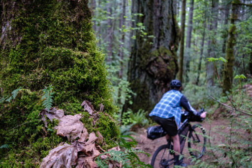
Motivated riders who pack lightly and ride swiftly can tackle this route as an ambitious, sundowning overnighter, but ample opportunities for detours to beaches, lakes, and local cuisine lend themselves well to covering the route at a more leisurely pace. Regardless of pace, those planning to tackle the Sea to Sea Regional Park section should be comfortable with remote singletrack that sees very little maintenance but offers excellent rewards to those who appreciate challenging singletrack and the quiet beauty of a west coast rainforest.
The modern Capital Regional District (CRD) administers the 13 municipalities of the region, but more importantly, conducts its business within the traditional territories of many First Nations, including the BOḰEĆEN (Pauquachin), MÁLEXEȽ (Malahat), P’a:chi:da?aht (Pacheedaht), Spune’luxutth’ (Penelekut), Sc’ianew (Beecher Bay), Songhees, SȾÁUTW̱ (Tsawout), T’Sou-ke, W̱JOȽEȽP (Tsartlip), W̱SIKEM (Tseycum), and xʷsepsəm (Esquimalt) peoples.
Route Difficulty
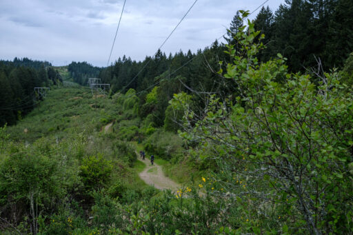
While many parts of the route are made of smooth rail grade and fire roads, due to the technical difficulty of some of the trails, including the Sooke Hills Wilderness Connector within the Sea to Sea Regional Park, which has sections of near mandatory hike a bike, the route has been given a 7 out of 10 difficulty rating. Additionally, while the route only has 4,400 feet of elevation gained over 85 miles, those miles don’t always come easily, particularly in the steep, relentless, and loose sections in Thetis Lake and Francis King Regional Parks. There are regular sections of single and doubletrack that are rocky, loose, and steep, which are suitable for riders with intermediate off-road/mountain bike experience. There are occasional narrow trails with regular obstacles and sustained steep grades, including some blue mountain bike trails. There are also frequent climbs, some of which may be steep and unrelenting and in excess of 20-percent grade. There is about a two-mile section that will require most riders to hike or push their bikes due to rugged trail conditions with uneven large rocks and steep grades.
Spreading the route over three days is a great way to take it at a more reasonable pace, which allows time to explore the mountain bike trails, take more swimming breaks, and eat at some the best cafes in the region. Note that from October to April of most years, you can expect slippery rocks and a variety of un-bridged creek crossings, which may raise the difficulty.
In peak months (approximately April to September), water is plentiful and available at public water stations as well as creeks, rivers, and lakes; all campsites have running water during these months. Restaurants and stores are frequent throughout the route, which makes resupply easy. As a result, riders can pack relatively lightly.
 This route is part of the Local Overnighter Project, which was created to expand our growing list of worldwide bikepacking routes—the first and largest of its kind—and create an independent map and catalog of great bikepacking overnighters, curated by you, from your own backyard. Our goal is to have accessible routes from every town and city in the world. Learn More
Submit Route Alert
As the leading creator and publisher of bikepacking routes, BIKEPACKING.com endeavors to maintain, improve, and advocate for our growing network of bikepacking routes all over the world. As such, our editorial team, route creators, and Route Stewards serve as mediators for route improvements and opportunities for connectivity, conservation, and community growth around these routes. To facilitate these efforts, we rely on our Bikepacking Collective and the greater bikepacking community to call attention to critical issues and opportunities that are discovered while riding these routes. If you have a vital issue or opportunity regarding this route that pertains to one of the subjects below, please let us know:
Highlights
Must Know
Camping
Food/H2O
Trail Notes
Resources
- Camping and swimming at the Sooke Potholes – unique geological formations – deep pools in the river rock – that offer chances for cliff jumping into the Sooke River – southern Vancouver Island’s second-largest river.
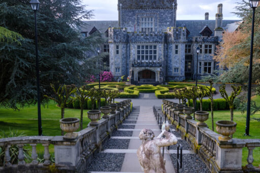
- Discovering the loamy and root-filled trails near Hatley Castle – a national historic site featured in several films, such as X-Men and Deadpool, and adjacent to a migratory bird sanctuary overlooking the Olympic Mountains.
- Exploring Leechtown – site of a former gold mining colony – the historic Deer Trail Resort – a crumbling cliffside ruin hidden in the woods in the Sooke Potholes Regional Park.
- The reward of a rip-roaring descent down Sooke Mountain Park Road after extended climbs and hike-a-bike on the Shepherd Creek Trail in the Sea to Sea Regional Park.
- Shredding the blue Kinnickinnick mountain bike trail at Harbourview before sending it down smooth doubletrack to connect to the Todd Creek Trestle – a 370-foot-long wood trestle built in 1918 and restored in 2020.
- Paralleling the Olympic Mountains and the Strait of Juan De Fuca on railway grade after leaving Sooke along the Galloping Goose trail.
- The option to explore some of the region’s best mountain bike trails at the Jordie Lund, Harborview, Thetis Lake, and Hartland riding areas.
- Relaxing and swimming at Langford Lake Beach Park and Matheson Lake (legend has it there is a rope swing if you look in the right place).
- Eating way too much gelato and pizza at Mosi (a bakery along the route), or practicing moderation and just buying a mascarpone and berry croissant for the road.
- Getting lost deep into in Douglas fir and Garry oak forest and ecosystems in Thetis Lake and Francis King Regional Parks.
- Riding the smooth gravel trails paralleling the Colquitz River, a recently restored salmon-bearing stream that acts as a spawning site for coho salmon.
- While the route can be ridden year-round, the Sundowner is best experienced between April and September due to warmer and drier weather, greater options for camp sites, and access to public water fountains, which are turned off in the fall/winter.
- There are no wild camping options available along the route, however, there are plenty of warmshowers and lodging options along the route in addition to the campsites noted.
- The route is best experienced on a hardtail but can be ridden on a rigid bike – 50mm or wider tires recommended
- The route starts and ends at the convergence of the two regional bike trails just north of downtown, close to grocery stores and a bicycle shop for last-minute supplies or repairs.
- The start/end point is 18 miles from Swartz Bay Ferry Terminal via the Lochside Trail for folks coming from the lower mainland (Vancouver, BC) or about three miles from the Black Ball Ferry Line, which provides daily sailings to Port Angeles, Washington.
- Street parking is available a few blocks west of the route if needed.
- There are a few creek crossings in the Sea to Sea Regional Park, which are much more difficult to navigate in the winter but will run dry in the peak of summer.
- There is a short one-mile section of highway riding connecting Humpback Road to the east entrance of the Sea to Sea Regional Park – there is a decent shoulder, and the speed limit is only about 50 miles per hour.
- Riders are encouraged to carry bear spray and store their food in a bear-safe manner due to the prevalence of black bears, squirrels, and miscellaneous rodents on the island.
- The trailhead is easily accessible – about three miles – from the Black Ball Ferry Line, which provides daily sailings to Port Angeles, Washington. Non-residents will require a passport to enter the country.
- Wild camping is not permitted at any point along the route.
- The route can be completed as an overnighter – camping at Goldstream Provincial Park (open year-round) or as a two-nighter – camping first near Sooke and then at Goldstream.
- There are plenty of lodging options near Sooke, including three campsites open during the spring and summer months.
- Goldstream Provincial Park is open year-round, but a reservation is recommended in peak summer months.
- There are also many warmshowers options along the more populated sections of the route.
- Water is plentiful along the route, including several public fountains that operate March through September. All campsites have running water.
- The route parallels many lakes and rivers that can be filtered for drinking water as well.
- There are several opportunities for food resupplies at stores and restaurants, our favorites being:
- Rhino Coffee and Donuts – a quick stop for caffeine and baked goods before the most challenging section of the route in the Sooke Hills.
- Mosi – a popular café with gelato, coffee, and some of the best pizza in the area.
- Hullabaloo Coffee and Ice Cream – a cute ice cream truck next to a grocery store that offers a discount if you arrive by bicycle.
- MyChosen Café and Pizza – slightly off route but amazing pizza. Owned and operated by a bikepacker!
Day 1
Riders depart the capital city on a mix of quiet streets and gravel trails before linking up with the Galloping Goose Regional Trail. Shortly after the trail turns into gravel, riders will be treated to a loamy, singletrack descent that pops them out overlooking the Juan De Fuca Strait at Royal Roads University – a historic military college, now the backdrop of Hollywood films, such as X-Men.
After exploring more singletrack trails in the university’s surrounding forest, the Sundowner links back up with the Galloping Goose before a quick detour through Langford’s Jordie Lunn Bike Park, which provides the first opportunity for extra-credit singletrack exploration. After paralleling a 100-year-old defunct concrete flowline that once provided water to the capital city, the route then begins its accent up into the mountains of the Sooke Hills, following rough and rocky singletrack.
After one mandatory section of hike-a-bike up a steep trail through the forest, riders are rewarded with a rowdy downhill linking up to an unpaved access road leading to the highest elevation point on the route at Sheilds Lake. After leaving the lake, the route quickly loses elevation, eventually connecting to the Harbourview Mountain Bike Trails as you make your way back towards the ocean. After connecting via some doubletrack along the Charters River, riders will eventually join up again with the Galloping Goose Trail, which can take you north to the Sooke Potholes Campground (recommended) or south to the town of Sooke and its various amenities.
Day 2
If camping at the Potholes, there is an optional detour to continue north until the Galloping Goose Trail ends to explore Leech town – remnants of a former gold mining town. Otherwise, riders should make time to swim in the refreshing Potholes before slowly cruising downhill alongside the Sooke River and over several trestles on rail-grade gravel. After re-supplying in Sooke, the route continues on the Galloping Goose Trail alongside the Sooke Basin, passing by several lakes for swimming and other opportunities to experience local cuisine. As the Goose brings you back towards the City of Langford, you’ll have the option to camp at Goldstream Provincial Park, which includes several hiking trails.
Day 3
The Sundowner meanders its way through Langford on a mix of roads and gravel trails before entering Thetis Lake Regional Park, which contains the third series of mountain bike trails ready for exploration – XC lovers rejoice! A series of steep gravel trails takes you north through the forest, becoming rougher as you delve into the more secluded reaches of the park. After another section of singletrack and a fast descent down a paved road, you begin to enter the Hartland Mountain Bike area – the largest mountain bike trail network in the region. A fun singletrack section past Killarney Lake will eventually lead to Elk Lake via rail grade and paved roads. After paralleling the west side of Elk Lake on a multi-use trail, the Sundowner eventually connects to a series of rail trails winding alongside the Colquitz River to complete the loop.
Additional Resources
Terms of Use: As with each bikepacking route guide published on BIKEPACKING.com, should you choose to cycle this route, do so at your own risk. Prior to setting out check current local weather, conditions, and land/road closures. While riding, obey all public and private land use restrictions and rules, carry proper safety and navigational equipment, and of course, follow the #leavenotrace guidelines. The information found herein is simply a planning resource to be used as a point of inspiration in conjunction with your own due-diligence. In spite of the fact that this route, associated GPS track (GPX and maps), and all route guidelines were prepared under diligent research by the specified contributor and/or contributors, the accuracy of such and judgement of the author is not guaranteed. BIKEPACKING.com LLC, its partners, associates, and contributors are in no way liable for personal injury, damage to personal property, or any other such situation that might happen to individual riders cycling or following this route.
Please keep the conversation civil, constructive, and inclusive, or your comment will be removed.


